Raymarine Marine GPS System User Manual
Page 72
RayTech Navigator User’s Guide
4-8
2. Type in a name (up to 13 characters including blanks) for
your route, or click
OK
to accept the default name of “Qr.”
Note:
Identical route names will overwrite each other
without a confirmation warning.
3. Click
OK
. The Standard cursor
changes to the Route
cursor
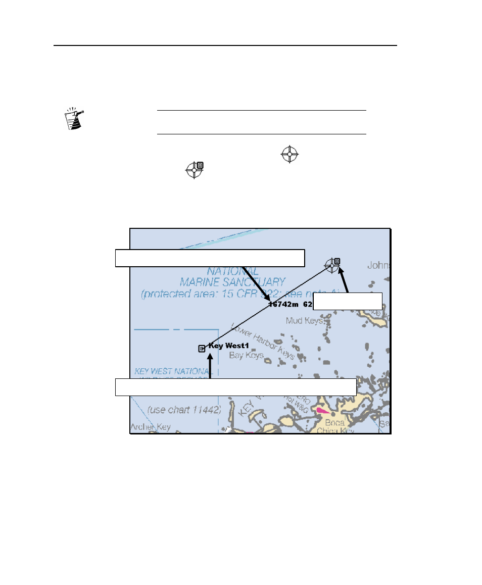
(Figure 4-8). Move the cursor over the area
where you want the route to begin, then left-click the mouse.
The route is started, and the name you chose along with range
and bearing of the first leg is displayed (Figure 4-8).
Figure 4-8. Beginning a Route
Route name appears at originating point and at each additional waypoint
Distance and bearing of leg appears between waypoints
Draw Route cursor
See also other documents in the category Raymarine GPS receiver:
- RAYTHEON E32001 (13 pages)
- RAYCHART 420 (101 pages)
- L365 (83 pages)
- SR50 (48 pages)
- A65 (100 pages)
- RS12 (50 pages)
- DSM300 (82 pages)
- NMEA Multiplexer (16 pages)
- Pathfinder (111 pages)
- Pathfinder Radar (244 pages)
- autopilot control unit (111 pages)
- VolvoPenta IPS Autopilot System DPU (16 pages)
- autopilot + ST4000+ (145 pages)
- stand-alone master instrument (45 pages)
- ST80 (15 pages)
- Raystar 125 (8 pages)
- RS12 (38 pages)
- ST6001 (48 pages)
- Pathfinder Radar Scanners (66 pages)
- Chartplotter (101 pages)
- Heading Sensor (24 pages)
- Ray430 (54 pages)
- Viewable Marine Displays (38 pages)
- C Series (244 pages)
- ST8001 (48 pages)
- hsb2 PLUS Series (246 pages)
- 631 PLUS (170 pages)
- navigation system (17 pages)
- ST8002 (48 pages)
- PowerPilot (18 pages)
- ST7002 (52 pages)
- GPS Kit (24 pages)
- 465 (107 pages)
- Ray54E (116 pages)
- GPS Plotter (131 pages)
- GPS navigation (75 pages)
- ST7001 (48 pages)
- 300 (136 pages)
- Raystar 120 (30 pages)
- autopilot (137 pages)
- DSM30 (34 pages)
- Platinum Chart Card (29 pages)
- ST6002 (56 pages)
- 320 (139 pages)