Furuno NAVNET 1833 User Manual
Page 184
5. CUSTOMIZING YOUR UNIT
5-14
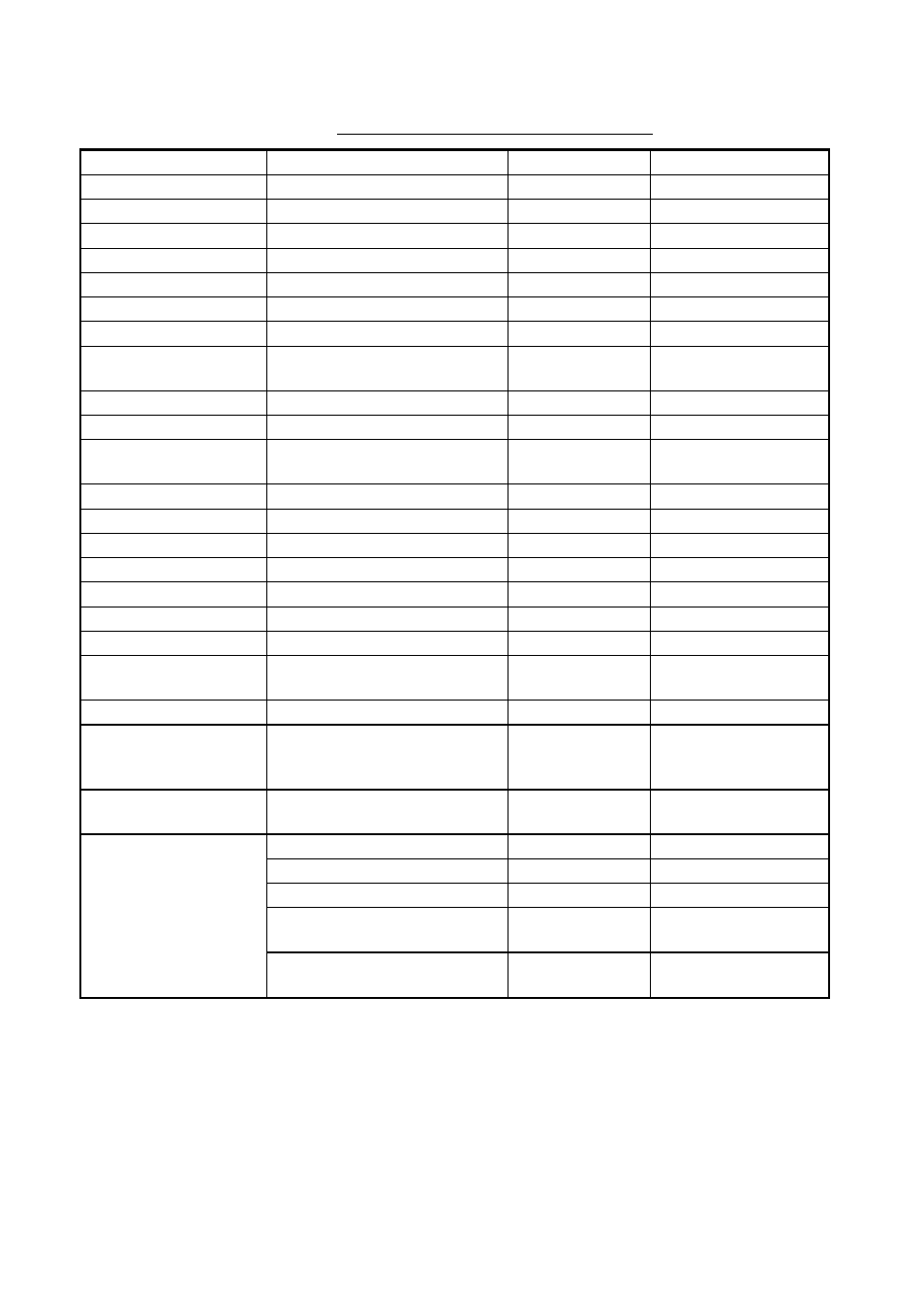
Contents of chart details menu (C-MAP)
Item Description
Settings
Default
Setting
Waypoint
Waypoint display
On, Off
On
Waypoint Name
Waypoint name
On, Off
On
Lat/Lon Grid
Latitude and longitude grids
On, Off
On
Chart Border Line
Border lines (indices)
On, Off
On
Port & Service
Port services icon display
On, Off
On
Attention Area
Attention area icon display
On, Contour, Off
On
Nav Lane
Navigation lanes
On, Off
On
Light
Lighthouse icon, sector
On, No Sector,
Off
On
Buoy & Beacon
Buoys, beacons display
On, Off
On
Signal
Signals category icon
On, Off
On
Cartographic Object
Cartographic objects category
icon
On, Off
On
Place Name
Geographic names
On, Off
On
Compass
Compass category icons
On, Off
On
Tide & Current
Tide display
On, Off
On
Natural Feature
Land outline
On, Off
On
River & Lake
Rivers and lakes
On, Off
On
Cultural Feature
Cultural features icons
On, Off
On
Landmark
Landmarks category icons
On, Off
On
Chart Generation
Chart generation category
icons
On, Off
On
New Object
New object category icons
On, Off
On
Complex Object Icon
Single or multiple icon for
object composed of several
icons
Multiple, Single
Multiple
Information Level
Basic or detailed data for
objects
Basic, Detailed
Basic
Bathymetric Line
On, Off
On
Spot Sounding
On, Off
On
Bottom Type
On, Off
On
Depth Area Limit
0-99999 ft
(m, fa, P
/
B)
33
ft (10 m, 6 fa,
6 P
/
B)
DEPTH INFO soft key
(See next page.)
Bathymetric Range
0-99999 ft
(m, fa, P
/
B)
0-3
0
ft (0-10 m, 0-6 fa,
0-6 P
/
B)