Chart attributes – Furuno NAVNET 1833 User Manual
Page 182
5. CUSTOMIZING YOUR UNIT
5-12
5.4.2 FURUNO,
NavCharts
™
chart attributes
FURUNO, NavCharts
™
chart attributes may be turned on or off from the CHART
DETAILS menu, which you may display as follows:
1. Press the [MENU] key.
2. Press the CHART SETUP and CHART DETAILS soft keys.
LAT/LON GRID
ON
TEXT INFORMATION
ON
WAYPOINTS
LARGE
WAYPOINT NAMES
ON
CHART BORDER LINES
ON
LANDMASS
BRIGHT
NAVAIDS
ON
LIGHT SECTOR INFO
ON
OTHER SYMBOLS
WHITE
MARKS SIZE
LARGE
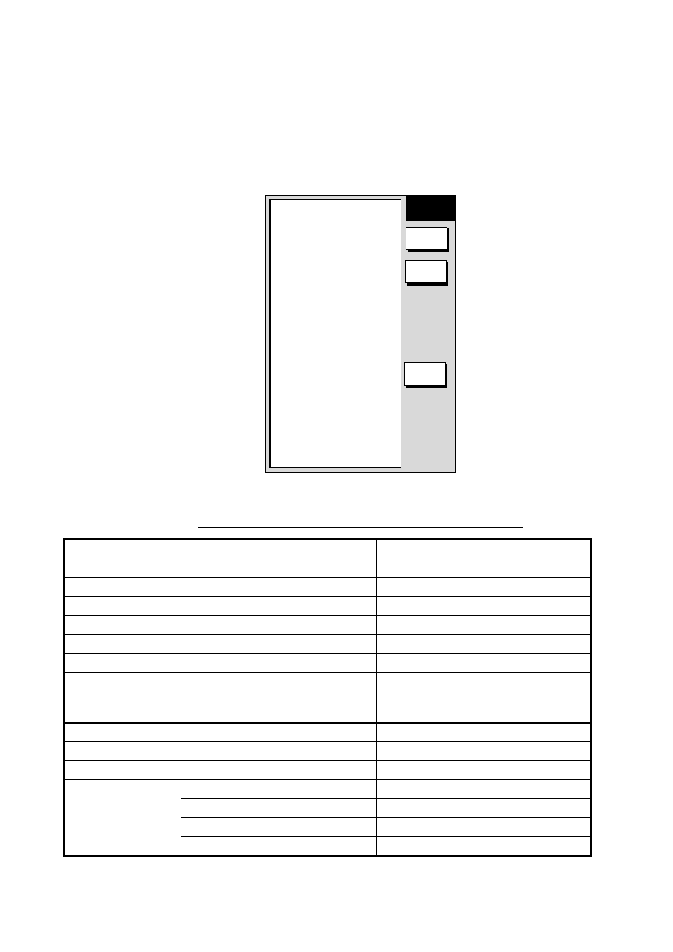
▲
CHART
DETAILS
EDIT
CNTOUR
LINE
RETURN
Chart details menu (FURUNO, NavCharts
™)
Contents of chart details menu (FURUNO, NavCharts
™
)
Item Description
Settings
Default
Setting
Lat/Lon Grid
Latitude and longitude grids
On, Off
On
Text Information
Geographic place, name
On, Off
On
Waypoints
Waypoint size
Large, Small, Off
Large
Waypoint Names
Waypoint name
On, Off
On
Chart Border Lines
Border lines (indices)
On, Off
On
Landmass
Landmass brilliance
Bright, Dim, Off
Bright
Navaids
Navaid data on NavCharts™;
lighthouse data on FURUNO
charts
On, Off
On
Light Sector Info
Lighthouse viewing sector
On, Off
On
Other Symbols
Other map symbols
On, Off
On
Marks Size
Mark size
Large, Small
Large
Depth < 10 m
On, Off
On
Depth = 10 m
On, Off
On
Depth > 10 m
On, Off
On
CNTOUR LINE
soft key
(See next page.)
Depth Information
On, Off
On