Na vigation, Additional settings – Mercedes-Benz GL-Class 2012 COMAND Manual User Manual
Page 87
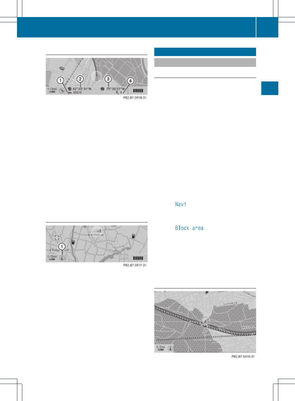
Geo-coordinate display
Geo-coordinate display active
:
Current height above average sea level
(rounded to the nearest 100 ft)
;
Current vehicle position: latitude
coordinates
=
Current vehicle position: longitude
coordinates
?
Number of GPS satellites currently being
used
There must be sufficient GPS reception for all
displays to be shown. If this is not the case,
the display will be grayed out. Height
display : may vary from the actual value,
because the navigation system uses the GPS
signal for the calculation.
"None" menu option
Display switched off
:
Currently set map orientation
i
During the "Move map" function, you can
see additional data depending on the
position of the crosshair, such as a road
name, if the digital map supports this data.
Additional settings
Avoiding an area
General information
COMAND makes it possible to avoid areas
you do not wish to drive through.
If you activate or deactivate a route block
while route guidance is active, COMAND will
calculate a new route. If you activate or
deactivate a route block while route guidance
is inactive, COMAND will use the new setting
for the next route guidance.
i
Freeways within blocked areas are always
taken into consideration in the route
calculation.
This function is not available while the
vehicle is in motion.
X
To switch to navigation mode: press the
Ø function button.
X
To show the menu: press the 9 button.
X
Select
Navi
in the main function bar using
the 9=; buttons and press the
9 button to confirm.
X
Select
Block area
and press the 9
button to confirm.
If you have not yet set an area to be
avoided, the map with the crosshair
appears (option 1).
If you have already set one or more areas
to be avoided, a list appears (option 2).
Option 1: the map appears
Additional settings
85
Na
vigation
Z