Navigat ion, Map operation and settings – Mercedes-Benz GL-Class 2012 COMAND Manual User Manual
Page 84
Unit of measurement = in the COMAND
display depends on the selection made for the
instrument cluster (see the vehicle
Operator's Manual).
Moving the map
Showing the crosshair
X
To hide the menu: press the 9 button
and when the
Full Screen
menu item is
shown, press the 9 button.
X
To scroll the map: press the =;
9: buttons.
A crosshair appears on the map. If you
press one of the buttons again, the map
moves under the crosshair in the
corresponding direction.
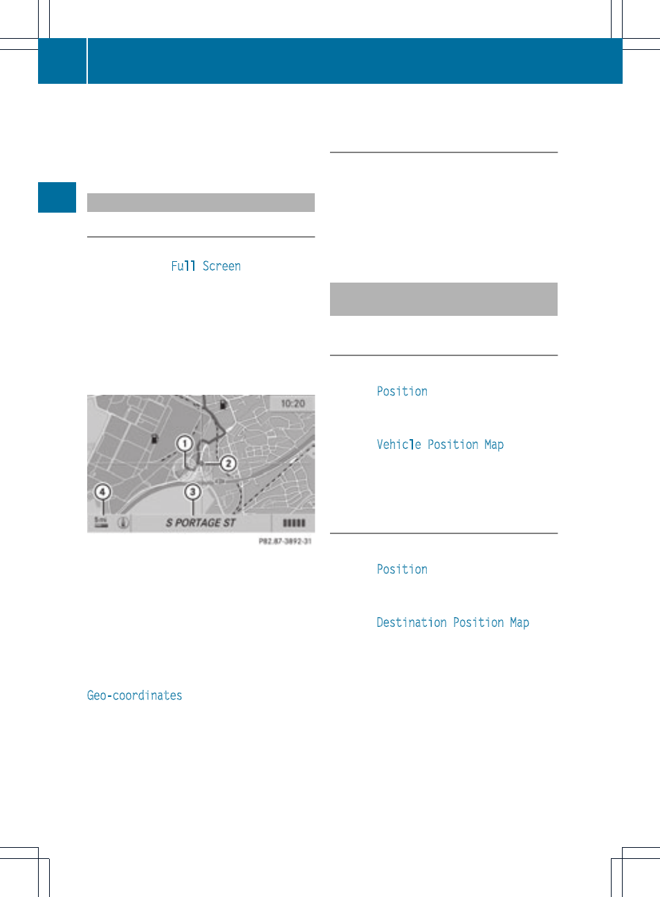
:
Current vehicle position
;
Crosshair
=
Details of the crosshair position
?
Map scale selected
Display = may be the name of a street, for
example, provided the digital map contains
the necessary data. Or it may show the geo-
coordinate position of the crosshair if the
Geo-coordinates
display is switched on
(
Y
page 85).
Hiding the crosshair and centering the
map on the vehicle position or
destination
X
Press the k button.
The crosshair disappears and the map is
set to the vehicle position.
or
X
Set the map to the vehicle position; see the
explanation below.
Centering the map on the vehicle or
destination position
Centering the map on the vehicle
position
X
To show the menu: press the 9 button.
X
Select
Position
in the navigation menu
bar using the :=; buttons and
press the 9 button to confirm.
X
Select
Vehicle Position Map
and press
the 9 button to confirm or, if the crosshair
is shown, press the % back button.
This hides the crosshair.
Centering on the destination
X
To show the menu: press the 9 button.
X
Select
Position
in the navigation menu
bar using the :=; buttons and
press the 9 button to confirm.
X
Select
Destination Position Map
and
press the 9 button to confirm.
The crosshair is centered on the
destination.
82
Map operation and settings
Navigat
ion