Comand, Navigation – Mercedes-Benz SL-Class 2013 Owners Manual User Manual
Page 369
X
Select
Topographic Map
and press W to
confirm.
Depending on the previous status, switch
the option on O or off ª.
The topographical map uses different colors
to depict elevation. The color key generally
reflects the topography's dominant
vegetation or the ground's perceived color
when seen from the air, for example:
R
green (grass) for lowland
R
yellow, brown (woodland) for hills
R
gray (stone) and white (snow) for
mountains.
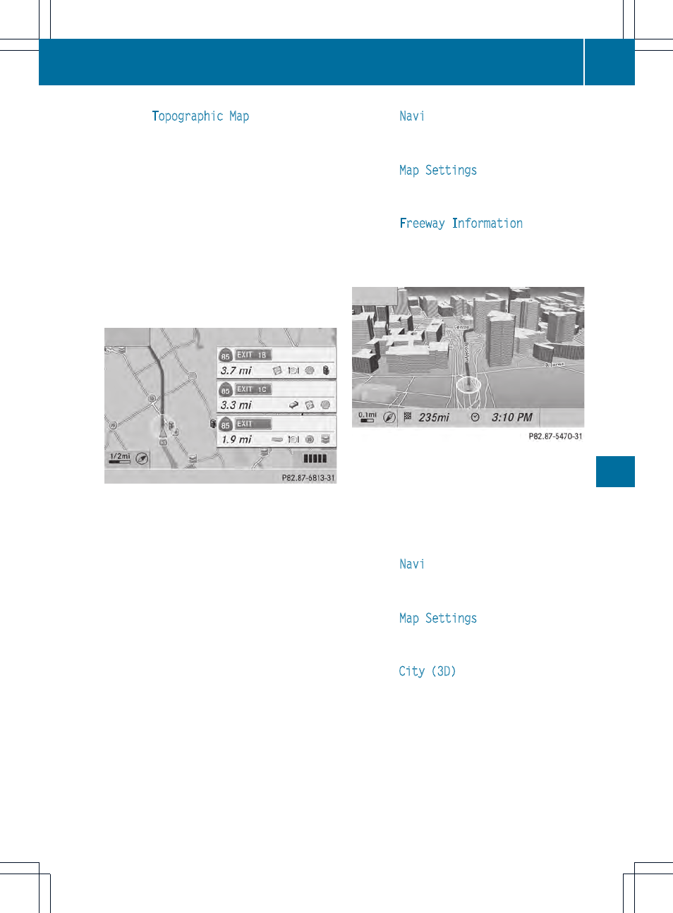
Example: freeway information
Switching highway information on/off
When driving on the freeway, you can see the
following information on the right of the
display:
R
the nearest gas stations
R
the nearest rest areas, etc.
R
and their distance from the current vehicle
position
The entries show the number of the
freeway and the freeway exits as well as
their distance from the current vehicle
position.
X
To switch on navigation mode: press the
Ø function button.
X
To show the menu: press W the COMAND
controller.
X
Select
Navi
in the main function bar by
sliding ZV and turning cVd the COMAND
controller and press W to confirm.
X
Select
Map Settings
and press W to
confirm.
The map settings menu appears.
X
Select
Freeway Information
and press
W to confirm.
Depending on the previous status, switch
the option on O or off ª.
Example: city model
Switching city view on/off
When the city model is switched on, the map
shows buildings in 3D.
X
To show the menu: press W the COMAND
controller.
X
Select
Navi
in the main function bar by
sliding ZV and turning cVd the COMAND
controller and press W to confirm.
X
Select
Map Settings
and press W to
confirm.
The map settings menu appears.
X
Select
City (3D)
and press W to confirm.
Depending on the previous status, switch
the option on O or off ª.
i
The city model is only shown for "Bird's-
eye View" or "3D Map".
It is available in the 0.05 mi and 0.1 mimap
scales.
The data required for displaying buildings
is not available for all cities.
Navigation
367
COMAND
Z