Comand, Navigation – Mercedes-Benz SL-Class 2013 Owners Manual User Manual
Page 368
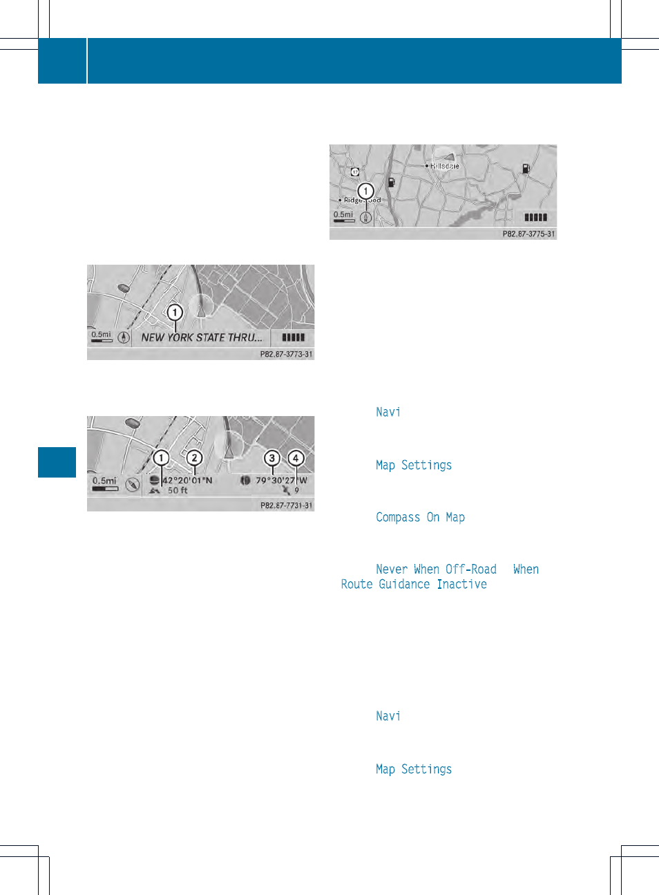
You can only see this display during route
guidance.
While moving the map, you will see additional
data, depending on the crosshair position, if
the digital map supports this data. This might
be a street name, for example.
During route calculation, or if the vehicle is
traveling on a non-digitized road, the linear
distance to the destination is shown. In this
case, the display will be grayed out.
Road display
:
Road names or numbers, e.g. for
highways
Geo-coordinate display
:
Current height above average sea level
(rounded to the nearest 10 m)
;
Current vehicle position: latitude
coordinates
=
Current vehicle position: longitude
coordinates
?
Number of GPS satellites currently being
used
There must be sufficient GPS reception for all
displays to be shown. If this is not the case,
the display will be grayed out. Height
display : may vary from the actual value,
because the navigation system uses the GPS
signals for the calculation.
During the "Move map" function, you will see
the geo-coordinates of the crosshair position.
Height display : and number of satellites
used ? are not displayed.
Display switched off
:
Current map orientation
While moving the map, you will see additional
data, e.g. road names, depending on the
crosshair position, if the digital map supports
this data (
Y
page 362).
Coordinates on the map
X
To show the menu: press W the COMAND
controller.
X
Select
Navi
in the main function bar by
sliding ZV and turning cVd the COMAND
controller and press W to confirm.
X
Select
Map Settings
and press W to
confirm.
The map settings menu appears.
X
Select
Compass On Map
and press W to
confirm.
A menu appears.
X
Select
Never
,
When Off-Road
or
When
Route Guidance Inactive
and press W
to confirm.
The selected setting is accepted.
Switching additional information on/off
Switching the topographic map on/off
X
To show the menu: press W the COMAND
controller.
X
Select
Navi
in the main function bar by
sliding ZV and turning cVd the COMAND
controller and press W to confirm.
X
Select
Map Settings
and press W to
confirm.
The map settings menu appears.
366
Navigation
COMAND