B&G Network GPSplus User Manual
Page 26
27
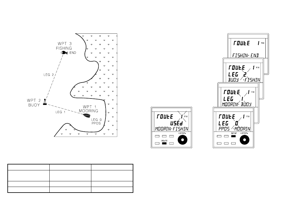
DIAGRAM SHOWING A SIMPLE ROUTE
A simple table as shown below can be very helpful when
planning a route. The latitude and longitude of each
waypoint could be added if required.
ROUTE LEG
FROM
TO
LEG 0
PPOS,
present position
MOORING
LEG 1
MOORING
BUOY
LEG 2
BUOY
FISHING
LISTING THE WAYPOINTS OF A STORED ROUTE
Press the ROUTE key and
turn the ▼ STEP ▲ knob to
view the route library. The
first and last waypoint
name or numbers are
displayed on the text line.
Press the SETUP key and
turn the ▼ STEP ▲ knob to
list the route LEG by LEG.