0 introduction 2.0 settings, 1 general settings, 0 introduction – Triton Bathymetry User Manual
Page 5: 0 settings
Page 1
1.0 Introduction
This document presents a sample workflow for processing bathymetry data using Triton’s
Perspective software. Also covered are some of the interpretation tools available in
Perspective and a brief discussion of export options.
Bathymetry data used for this document were collected for the Shallow Survey 2012
common dataset in Wellington Bay, New Zealand.
Having Perspective open and following along with this document from start to end will
provide the user with a basic understanding of how the software works and the tools
available with the BathyOne bathymetry processing module in Perspective.
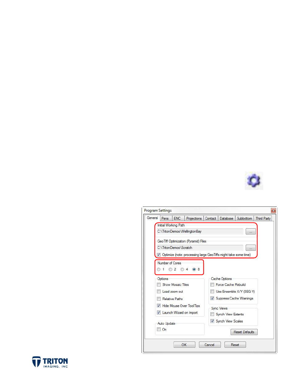
2.0 Settings
Before getting started it is best to review the
Program Settings
and verify they are
correct. The
Program Settings
are accessed by either selecting the toolbar
button shown right or by selecting the
Settings Info
option in the
View
menu.
2.1 General Settings
FILE PATHS: In the
General
settings
tab there are two file paths to set.
The top one called
Initial Working Path
sets the default folder for Perspective
to look in for importing and saving
files.
The second file path option sets the
location for creating pyramid files
which increases the speed of zooming
in and out of large GeoTiffs.
In addition to setting the file path, it
is important to also select the
Optimize
checkbox to activate this
feature.