5 geotiff, 6 kml – Triton Bathymetry User Manual
Page 47
Page 43
The BAG (Bathymetry Attributed Grid) file is a non-proprietary format for storing and
exchanging bathymetric data and was developed by the Open Navigation Surface Working
Group.
9.5 GeoTiff
The gridded bathymetry data can be exported to a GeoTiff by right-clicking on the grid
file in the DTM or CUBE file tree and selecting the GeoTiff export option. This will
export a GeoTiff at the selected resolution of the entire bathymetry grid with no other
information overlain on the image.
It is also possible to export to what we refer to as a
Composite GeoTiff
since it contains
everything that is displayed in the map view with the bathymetry grid clipped to the view
extent. This is done by selecting export from the main
File
menu.
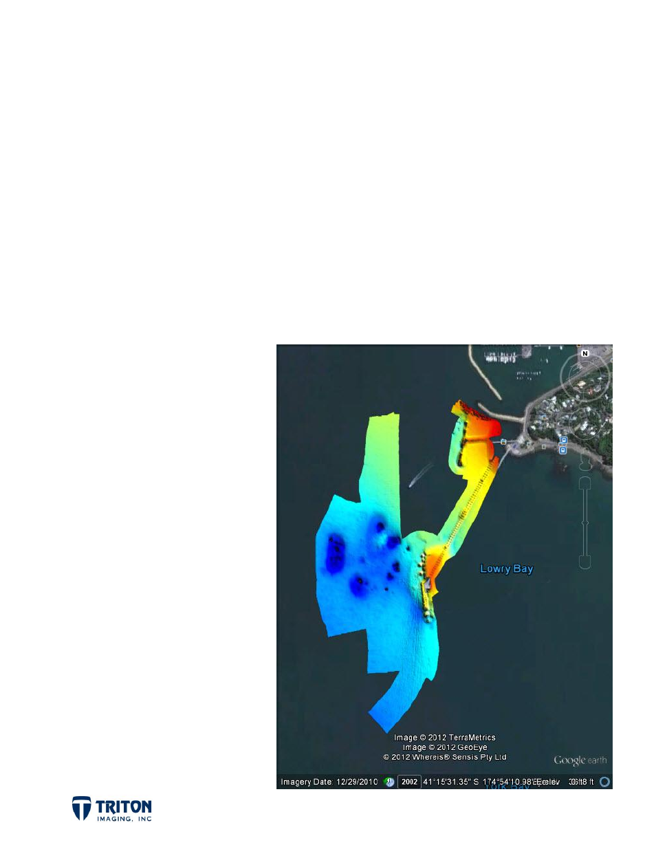
9.6 KML
The gridded bathymetry can
also be exported to a Google
Earth KML file. This is
accomplished by right-clicking
on the grid file in the DTM or
CUBE file tree and selecting the
KML export option. This will
export a KML file of the entire
bathymetry grid with no other
information overlain on the
image as shown right.
It is also possible to export to
what we refer to as a
Composite
KML
since it contains everything
that is displayed in the map view
with the bathymetry grid
clipped to the view extent. This
is done by selecting export from
the main
File
menu.