0 editing – Triton Bathymetry User Manual
Page 30
Page 26
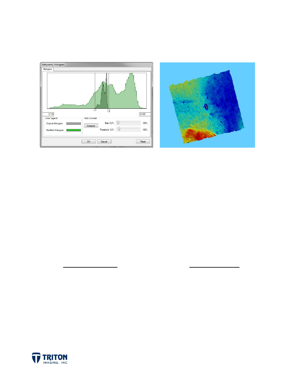
What causes this affect is a combination of the relatively flat seafloor with some low
frequency noise that stretches the data range. Adjusting the
Histogram
allows the user
to confine the stretched color palette to a specified range of values as shown below.
Note that the original
Histogram
stretched the color map from 13.95m to 28.5m while the
revised
Histogram
was set to range just from 21m to 23m depth.
By combining the relief shading settings with the color options and histogram adjustments,
subtle details in the data can be enhanced for better interpretation.
7.0 Editing
After the sounding data has been gridded, if there was noise in the data that was not
removed by the automatic filters then some manual editing may be necessary. In
Perspective there are two options for manual editing:
2D Swath Editor
3D Area Editor
Works on single line
Works on multiple lines
Cursor lock with map position
Define area by drawing box in map view
Across-track, along-track and top views
3D view with rotate, zoom and slicing
Can set “designated” soundings
Can view “designated” soundings
Use to review all data or select locations
Use to review select locations