Additional features – Garmin G950 Tecnam 2006T User Manual
Page 298
Garmin G950 Pilot’s Guide for the Tecnam P2006T
190-01146-00 Rev A
286
ADDITIONAL FEATURES
SY
STEM
O
VER
VIEW
FLIGHT
INSTRUMENTS
EIS
AUDIO P
ANEL
& CNS
FLIGHT
MANA
GEMENT
HAZARD
AV
OID
ANCE
AFCS
ADDITIONAL FEA
TURES
APPENDICES
INDEX
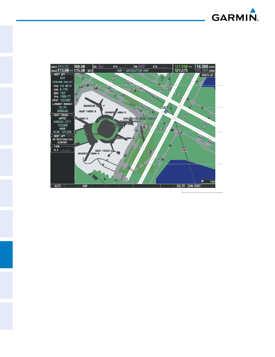
During ground operations the aircraft’s position is displayed in reference to taxiways, runways, and airport
features. In the example shown, the aircraft is on taxiway Bravo approaching the High Alert Intersection boundary
on KSFO airport. Airport Hot Spots are outlined in magenta. When panning over the airport, features such as
runway holding lines and taxiways are shown at the cursor.
DCLTR Softkey
Removes
Taxiway
Markings
Airport
Features
Taxiway
Identification
Airport Hot
Spot Outline
Figure 8-1 SafeTaxi Depiction on the Navigation Map Page
Aircraft
Position
The DCLTR Softkey (declutter) label advances to DCLTR-1, DCLTR -2, and DCLTR-3 each time the softkey is
pressed for easy recognition of decluttering level. Pressing the DCLTR Softkey removes the taxiway markings and
airport feature labels. Pressing the DCLTR-1 Softkey removes VOR station ID, the VOR symbol, and intersection
names if within the airport plan view. Pressing the DCLTR-2 Softkey removes the airport runway layout, unless
the airport in view is part of an active route structure. Pressing the DCLTR-3 Softkey cycles back to the original
map detail. Refer to Map Declutter Levels in the Flight Management Section.