Hazard avoidance – Garmin G950 Tecnam 2006T User Manual
Page 285
190-01146-00 Rev. A
Garmin G950 Pilot’s Guide for the Tecnam P2006T
273
HAZARD AVOIDANCE
SY
STEM
O
VER
VIEW
FLIGHT
INSTRUMENTS
EIS
AUDIO P
ANEL
& CNS
FLIGHT
MANA
GEMENT
HAZARD
AV
OID
ANCE
AFCS
ADDITIONAL
FEA
TURES
APPENDICES
INDEX
Showing/hiding aviation information on the Terrain Proximity Page:
1)
Press the MENU Key.
2)
Select ‘Show Aviation Data’ or ‘Hide Aviation Data’ (choice dependent on current state) and press the ENT Key.
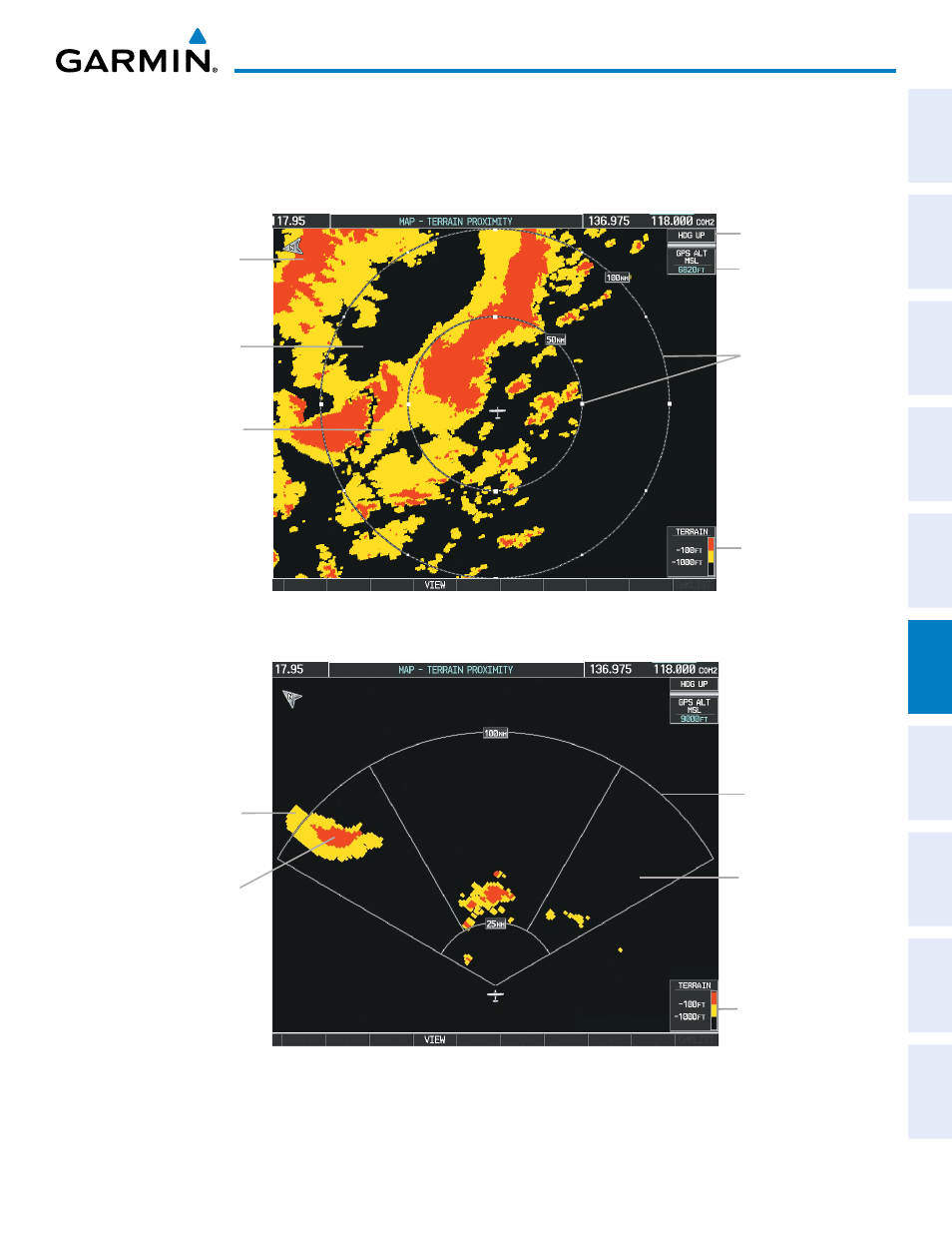
Figure 6-6 Terrain Proximity Page
Yellow Terrain
(Between 100’
and 1000’ Below
the Aircraft
Altitude)
Black Terrain
(More than
1000’ Below the
Aircraft Altitude)
Terrain Legend
Map Range Rings
Map Orientation
Current Aircraft
GPS-derived
MSL Altitude
Red Terrain
(Above or Within 100’
Below the Aircraft
Altitude)
Figure 6-7 Terrain Proximity Page (ARC View)
Yellow Terrain
(Between 100’ and
1000’ Below the
Aircraft Altitude)
Red Terrain
(Above or Within
100’ Below the
Aircraft Altitude)
Black Terrain
(Terrain More
than 1000’
Below the
Aircraft Altitude)
Map Range Arcs
Terrain Legend