Flight management – Garmin G950 Tecnam 2006T User Manual
Page 161
190-01146-00 Rev. A
Garmin G950 Pilot’s Guide for the Tecnam P2006T
149
FLIGHT MANAGEMENT
SY
STEM
O
VER
VIEW
FLIGHT
INSTRUMENTS
EIS
AUDIO P
ANEL
& CNS
FLIGHT
MANA
GEMENT
HAZARD
AV
OID
ANCE
AFCS
ADDITIONAL
FEA
TURES
APPENDICES
INDEX
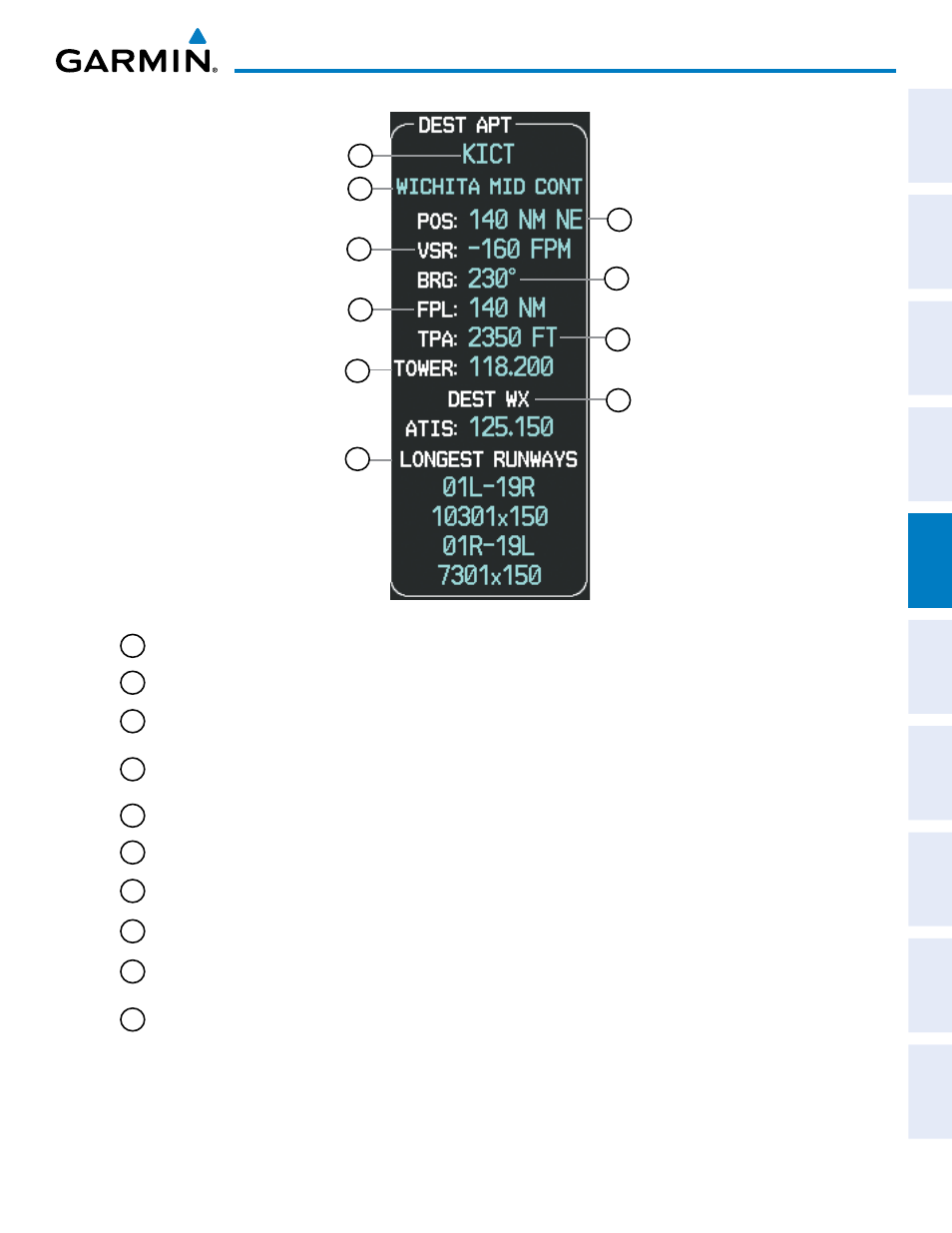
Figure 5-34 Destination Airport Box
1
2
4
6
8
3
5
7
9
10
1
Airport Identifier; always visible
2
Airport Name; always visible
3
Position From; distance and bearing from Destination Airport (visible when the destination mode is active, or when
the Nearest Airport is same as the destination airport, or when no ARTCC frequencies are detecetd
4
Vertical Speed Required. Vertical speed necessary at current ground speed to perform a straight descent to airport,
with a maximum of 5000, beyond which it becomes dashed: “----”. Visible when destination mode active, or when
nearest airport is same as destination airport, or when no ARTCC frequencies are detected
5
Bearing To, directional bearing to destination airport, always visible
6
Route Distance; total distance from present position to final destination through all waypoints, always visible
7
Traffic Pattern Altitude; Traffic Pattern Altitude of destination airport. Visible when destination mode active, or
when nearest airport is same as destination airport, or when one or fewer ARTCC frequencies are detected
8
COM Frequency, frequency of airport primary communication channel. Visible when destination mode active, or
nearest airport is same as destination airport.
9
Nearest Weather Station; frequency of weather station nearest to destination airport. Visible when destination
mode active, or nearest airport is same as destination airport
10
Longest Runways, identifier and size of the longest or the two longest runways. Identifier and size of the longest or
the two longest runways. One: Always visible; Two: visible when destination mode active, or nearest airport is same
as destination airport