Creating a waypoint referenced from – BendixKing KLX 135A - Pilots Guide User Manual
Page 121
7.
Use the right outer knob to move
the cursor, and the right inner
knob to select the proper
numbers to complete the latitude
entry (figure 4-85).
8.
Press
F
. The cursor will move
to the longitude field.
9.
Enter the longitude in the same
manner as the latitude
(figure 4-86).
10. Press
F
to approve this
position. The cursor will
automatically turn off
(figure 4-87).
4.4.3.
CREATING A WAYPOINT REFERENCED FROM
ANOTHER WAYPOINT
The third method of creating a user-defined waypoint is as a radial
and distance from a known waypoint.
To create a user-defined waypoint using the radial/distance
method:
1.
From any supplemental waypoint (SUP) page, turn on the cursor
(
B
). It will flash over the first character in the waypoint
identifier field.
2.
Use the right inner knob to select the first character of the
identifier. Remember that when
the cursor is on, the right inner
knob changes the character and
the right outer knob moves the
cursor around.
3.
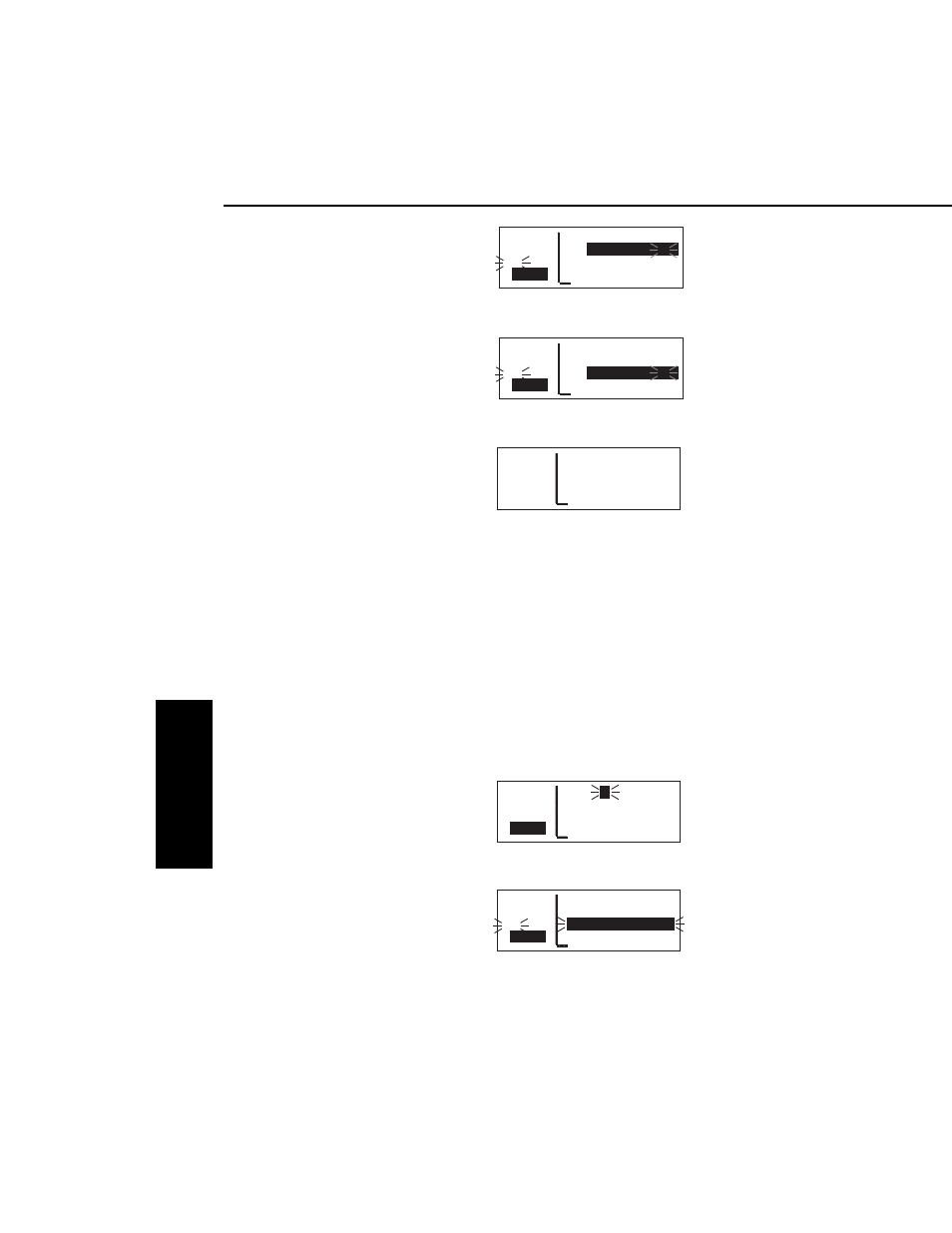
Spell out the rest of the identifier
using the right inner and outer
knobs (figure 4-88).
4.
Move the cursor down to the third
line, over User Pos R/D?
(figure 4-89).
Advanced GPS Operation
4-24
Effective Date 5/95
006-08789-0000 Rev 0
Advanced GPS Operation
Chapter 4
APT VOR NDB SUP ACT NAV FPL CAL SET OTH
118.00 FCTR
Y
USR at:
136.97 User Pos L/L?
>Leg User Pos R/D?
CRSR
Present Pos?
Figure 4-88
APT VOR NDB SUP ACT NAV FPL CAL SET OTH
118.00 FCTRY USR at:
136.97 User Pos L/L?
#>Leg
User Pos R/D?
CRSR
Present Pos?
Figure 4-89
APT VOR NDB SUP ACT NAV FPL CAL SET OTH
118.00 FARM USR
136.97
N 42°56.32'
#>Leg
W 76°29.95'
CRSR
>---°To ----nm
Figure 4-86
APT VOR NDB SUP ACT NAV FPL CAL SET OTH
118.00 FARM USR
136.97 N 42°56.32'
>Leg W 76°29.95'
SUP 1 >035°To 6.7nm
Figure 4-87
APT VOR NDB SUP ACT NAV FPL CAL SET OTH
118.00 FARM USR
136.97
N 42°56.32'
#>Leg ____°__.__'
CRSR
>---°To ----nm
Figure 4-85