Viewing distance, ete, eta, or desired track – BendixKing KLX 135A - Pilots Guide User Manual
Page 110
4.2.5.
VIEWING DISTANCE, ETE, ETA, OR DESIRED TRACK
TO FLIGHT PLAN WAYPOINTS
The active flight plan (FPL 0) page has a data field to the right of
each waypoint in the flight plan. This field may be used to display the
cumulative distance (Dis) from the present position to each waypoint,
the estimated time en route (ETE), the estimated time of arrival (ETA,
for which the time zone abbreviation is displayed), or the magnetic
desired track (Dtk) between each waypoint.
If you have more than four waypoints in FPL 0, you may wish to view
flight data for waypoints which are not displayed on the screen. If this
is the case, turn on the cursor (
B
) and use the right outer knob to
scroll down the flight plan until the waypoint of interest is on the
screen.
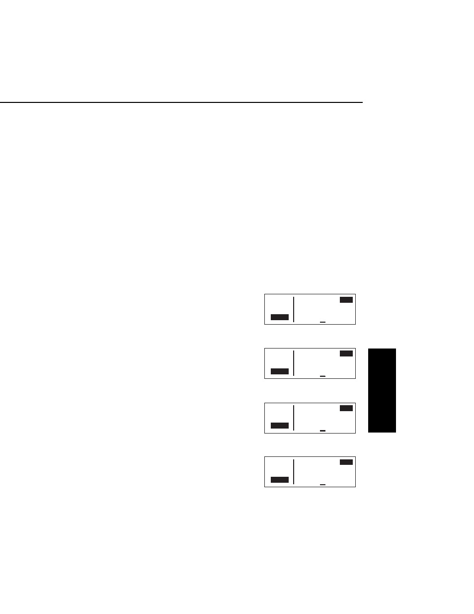
This display will default to the distance presentation at power-on
(figure 4-45). The area in the upper right hand corner of the screen is
a cyclic field, which means that . . .
To cycle between distance, ETE, ETA, and desired track on the
FPL 0 page:
1.
Turn on the cursor (
B
); it will
come up over the cyclic field,
which in this case is displaying
distance (Dis) in nautical miles
(figure 4-45).
2.
Press
E
. Subsequent presses
of the
E
button will cycle
through ETE in hours:minutes
(figure 4-46), ETA in terms of the
system time zone (figure 4-47),
magnetic Dtk (figure 4-48), then
back to Dis.
KLX 135A Pilot’s Guide
Advanced GPS Operation
4-13
Effective Date 5/95
006-08789-0000 Rev 0
Advanced GPS Operation
Chapter 4
APT VOR NDB SUP ACT NAV FPL CAL SET OTH
118.00 ≤ 1:KZZV >
Dis
136.97 ≥ 2:APE 22
>Leg 3:DQN 106
CRSR
5:KIND 204
Figure 4-45
APT VOR NDB SUP ACT NAV FPL CAL SET OTH
118.00 ≤ 1:KZZV >
ETE
136.97 ≥ 2:APE 0:08
>Leg 3:DQN 0:44
CRSR
5:KIND 1:27
Figure 4-46
APT VOR NDB SUP ACT NAV FPL CAL SET OTH
118.00 ≤ 1:KZZV >
UTC
136.97 ≥ 2:APE 1535
>Leg 3:DQN 1612
CRSR
5:KIND 1654
Figure 4-47
APT VOR NDB SUP ACT NAV FPL CAL SET OTH
118.00 ≤ 1:KZZV >
Dtk
136.97 ≥ 2:APE 291°
>Leg 3:DQN 265°
CRSR
5:KIND 147°
Figure 4-48