Navigation, Introduction – Mercedes-Benz G-Class 2010 COMAND Manual User Manual
Page 62
“None” Menu Option
Map with display switched off
1
Currently set map orientation
i
In the
Move Map function you will see
other data depending on crosshairs
position, for example a road name if the
digital map supports this data.
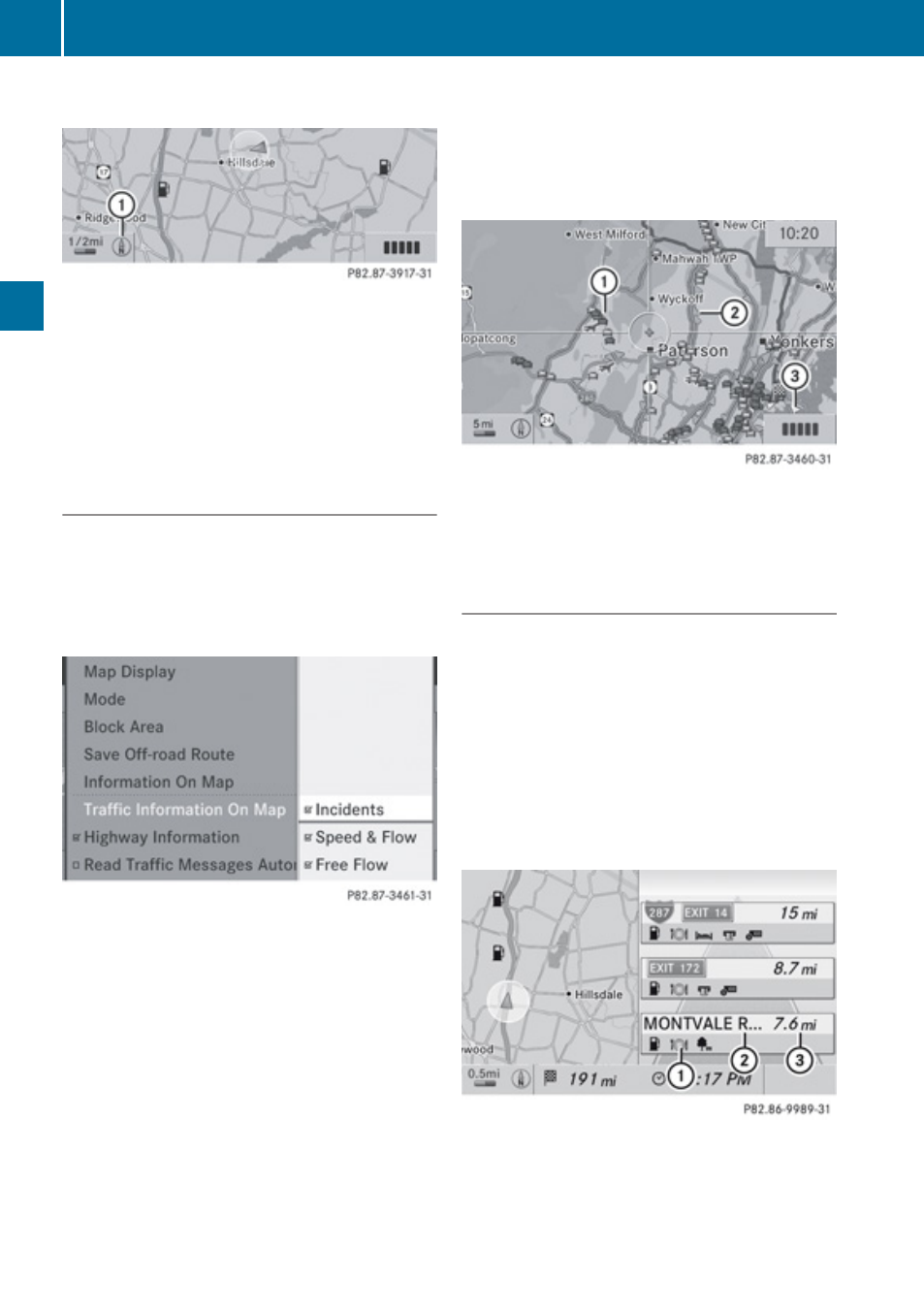
Traffic Information on Map
Provided you have a subscription to SIRIUS
XM Satellite Radio Traffic Message Service,
you can have the traffic information displayed
on the map. There are three different
categories of information you can select.
R
Incidents
Road sections marked by a yellow line with
spikes =: traffic slowdown possible due to
incidents (e.g road works)
R
Speed and Flow
Road sections marked by yellow cars, red
cars or red crosses (xxx):.
Yellow cars: Traffic congestion, average
speed 25
–
45
mph.
Red cars: Traffic congestion, average
speed 5
–
20
mph.
Red crosses: Blocked road section
R
Free Flow
Road sections marked by a green line with
spikes ;: free flow of traffic.
1
Speed and Flow
2
Free Flow
3
Incidents
Highway Information
When driving on highways, you can have the
next gas stations, service areas, etc. as well
as the distance to them displayed in the right-
hand half of the screen.
X
To set: Display menu system if applicable
X
Select
Navi£Highway Information.
Depending on the previous status, the
function will be switched offcor on Ç.
Example display: Function on
1
Information type: Rest area
2
Name of rest area
3
Distance from the current vehicle location
60
Introduction
Navigation