Navigation, Introduction – Mercedes-Benz G-Class 2010 COMAND Manual User Manual
Page 61
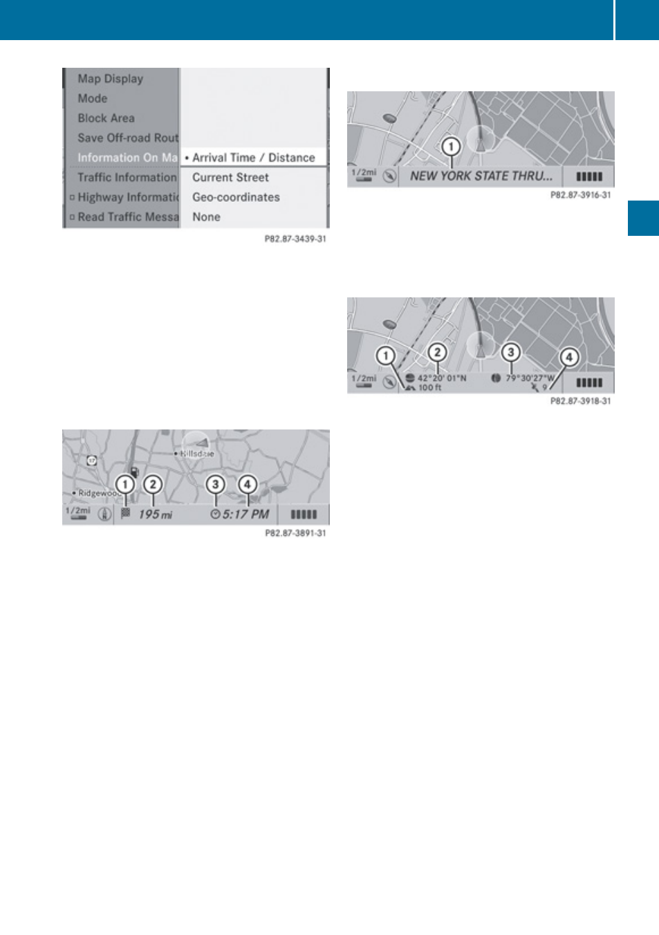
A dot R indicates the current setting.
X
Select
Arrival Time/Distance or
Current Street or Geo-coordinates or
None.
X
To exit menu: Press = or ;.
X
Hide menu system if applicable
(
Time of Arrival/Distance to Destination
Map with display activated for time of arrival/
distance
1
Symbol for destination
2
Distance to the destination
3
Symbol for estimated time of arrival
4
Estimated time of arrival
i
This display can only be seen during route
guidance. In the
Move Map function you will
see other data depending on the crosshairs
position, for example a street name if the
digital map supports this data.
Current Street
Map with road display activated
1
Road name or road number, e.g. for
highways
Geo-Coordinates Display
Map with geo-coordinates display activated
1
Current height above sea level (rounded
off to 50 m)
2
Coordinates display of the current vehicle
location (latitude)
3
Coordinates display of the current vehicle
location (longitude)
4
Number of GPS satellites currently being
used.
i
Adequate GPS reception must be
available for all displays. The altitude
display 1 may differ from reality because
the navigation system calculates it using
the GPS signals.
i
In the
Move Map function the display 1
and 4 are not displayed. The geo-
coordinate position of crosshairs is
displayed.
Introduction
59
Navigation
Z