Terrain-svs page, Hazard avoidance – Garmin G1000 Socata TBM 850 User Manual
Page 382
Garmin G1000 Pilot’s Guide for the Socata TBM 850
190-00709-02 Rev. B
368
HAZARD AVOIDANCE
SY
STEM
O
VER
VIEW
FLIGHT
INSTRUMENTS
EAS
AUDIO P
ANEL
& CNS
FLIGHT
MANA
GEMENT
HAZARD
AV
OID
ANCE
AFCS
ADDITIONAL FEA
TURES
APPENDICES
INDEX
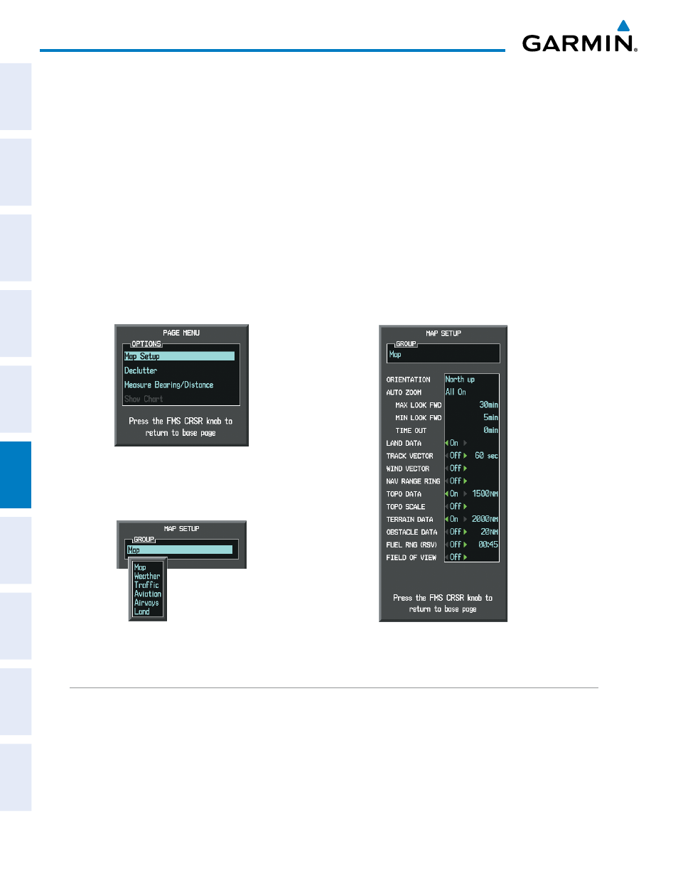
Customizing terrain and obstacle display on the Navigation Map Page:
1)
Select the Navigation Map Page.
2)
Press the MENU Key.
3)
With Map Setup highlighted, press the ENT Key (Figure 6-79).
4)
Turn the small FMS Knob to select the Map Group and press the ENT Key (Figure 6-80).
5)
Turn the large FMS Knob or press the ENT Key to scroll through product selections (Figure 6-81.
•
TERRAIN DATA – Turns the display of terrain data on or off and sets maximum range at which terrain is shown
•
OBSTACLE DATA – Turns the display of obstacle data on or off and sets maximum range at which obstacles are shown
6)
Turn the small FMS Knob to scroll through options for each product (ON/OFF, range settings).
7)
Press the ENT Key to select an option.
8)
Press the FMS Knob or CLR Key to return to the Navigation Map Page with the changed settings.
Figure 6-80 Navigation Map Page Setup Menu
Figure 6-79 Navigation Map Page Menu
Figure 6-81 Navigation Map Page Setup Menu, Map Group
TERRAIN-SVS PAGE
The TERRAIN-SVS Page is specialized to show terrain, obstacle, and potential impact point data in relation
to the aircraft’s current altitude, without clutter from the basemap. Aviation data (airports, VORs, and other
NAVAIDs) can be displayed for reference. If an obstacle and the projected flight path of the aircraft intersect,
the display automatically zooms in to the closest potential point of impact on the TERRAIN-SVS Page.