Flight management, Symbol setup – Garmin G1000 Socata TBM 850 User Manual
Page 182
Garmin G1000 Pilot’s Guide for the Socata TBM 850
190-00709-02 Rev. B
168
FLIGHT MANAGEMENT
SY
STEM
O
VER
VIEW
FLIGHT
INSTRUMENTS
EAS
AUDIO P
ANEL
& CNS
FLIGHT
MANA
GEMENT
HAZARD
AV
OID
ANCE
AFCS
ADDITIONAL FEA
TURES
APPENDICES
INDEX
SYMBOL SETUP
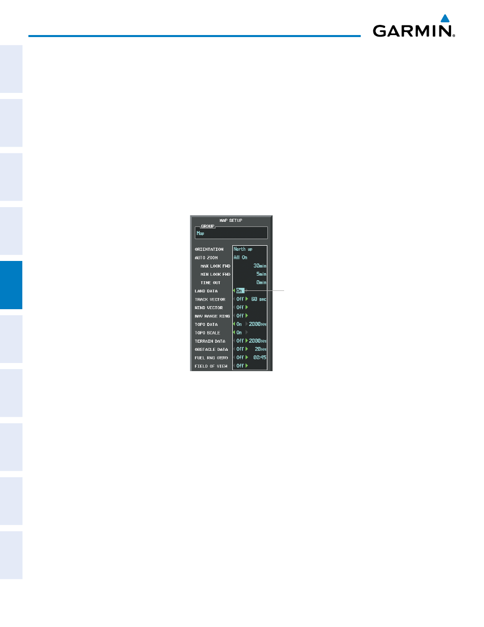
All pages with maps can display land symbols (roads, lakes, borders, etc). Land symbols can be removed
totally (turned off).
Displaying/removing all land symbols:
1)
Press the MENU Key with the Navigation Map Page displayed. The Page Menu is displayed and the cursor
flashes on the ‘Map Setup’ option.
2)
Press the ENT Key. The Map Setup Group Menu is displayed and the cursor flashes on the ‘Map’ option.
3)
Highlight the ‘LAND DATA’ field.
4)
Select ‘On’ or ‘Off’.
5)
Press the FMS Knob to return to the Navigation Map Page.
Figure 5-18 Navigation Map Setup Menu - LAND DATA Setup
LAND DATA
On/Off
The label size (TEXT) sets the size at which labels appear on the display (none, small, medium, and large).
The range (RNG) sets the maximum range at which items appear on the display.
Selecting a ‘Land’ or ‘Aviation’ group item text size and range:
1)
Press the MENU Key with the Navigation Map Page displayed. The cursor flashes on the ‘Map Setup’ option.
2)
Press the ENT Key. The Map Setup Menu is displayed.
3)
Select the ‘Land’ or ‘Aviation’ group.
4)
Press the ENT Key. The cursor flashes on the first field.
5)
Select the desired land option.
6)
Select the desired text size.
7)
Press the ENT Key to accept the selected size.
6)
Select the desired range.