Sirius weather, Weather forecasts – Mercedes-Benz C-Sedan 2015 COMAND Manual User Manual
Page 210
Moving the weather map
X
Slide 4 or 1 the controller.
The weather map moves in the correspond-
ing direction under the crosshair.
Changing the scale
X
Turn the controller.
The scale bar appears.
X
Turn until the desired scale is set.
Showing/hiding the menu in the
weather map
X
To show: press the controller.
X
To hide: slide 5 the controller.
Selecting a weather station in the map
X
Move the weather map and crosshair to the
desired position (
Y
page 208).
X
To show the menu: press the controller.
X
To select
Weather Table
Weather Table
: press the con-
troller.
COMAND receives the weather data for the
selected position from the nearest weather
station and displays it automatically as a
daily forecast.
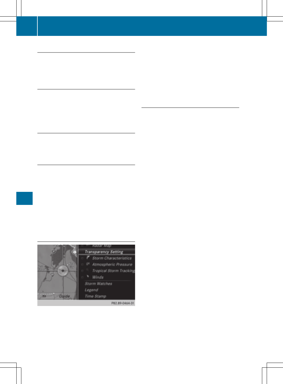
Switching layers on the map on/off
You can switch on different layers, for exam-
ple to display the rain radar, weather fronts
and the course of tropical storms on the map.
X
Display the menu on the weather map
(
Y
page 208).
X
To select
View
View
: turn and press the control-
ler.
X
Select a layer.
Switch the display on O or off ª.
Explanation of the layers on the
weather map
R
Menu item
Radar Map
Radar Map
Displays the rain radar as a color area in all
map scales. For an explanation of the col-
ors, see the legend (
Y
page 211).
R
Menu item
Storm Characteristics
Storm Characteristics
Displays the characteristics of a storm in
all map scales:
-
tornadic storm:
storm cell with strong winds (super cell),
from which a tornado can develop. Tor-
nadoes are also known as twisters.
-
cyclone:
storm cells from which a tornadic storm
can develop
-
hailstorm
-
the likelihood of a hailstorm
R
Storm watch areas
Shows areas for which storm advisories
have been issued (red areas). It is shown in
map scales 50 mi (50 km), 200 mi
(200 km) and 500 mi (500 km).
R
Menu item
Atmospheric Pressure
Atmospheric Pressure
Shows the position of high and low-pres-
sure areas (H, L), weather fronts and iso-
bars It is shown in map scales 200 mi
(200 km) and 500 mi (500 km).
R
Menu item
Tropical Storm Tracking
Tropical Storm Tracking
Shows the direction and speed of propaga-
tion (track) of a tropical storm in all map
scales with information on times and inten-
sity.
R
Menu item
Winds
Winds
Shows the wind direction and wind speed
in map scale of 5 mi (5 km).
208
Weather forecasts
SIRIUS
Weather