Additional features, Runways – Garmin G1000 Quest Kodiak User Manual
Page 361
190-00590-01 Rev. B
Garmin G1000 Pilot’s Guide for the Quest Kodiak 100
349
ADDITIONAL FEATURES
SY
STEM
O
VER
VIEW
FLIGHT
INSTRUMENTS
EIS
AUDIO P
ANEL
& CNS
FLIGHT
MANA
GEMENT
HAZARD
AV
OID
ANCE
AFCS
ADDITIONAL
FEA
TURES
APPENDICES
INDEX
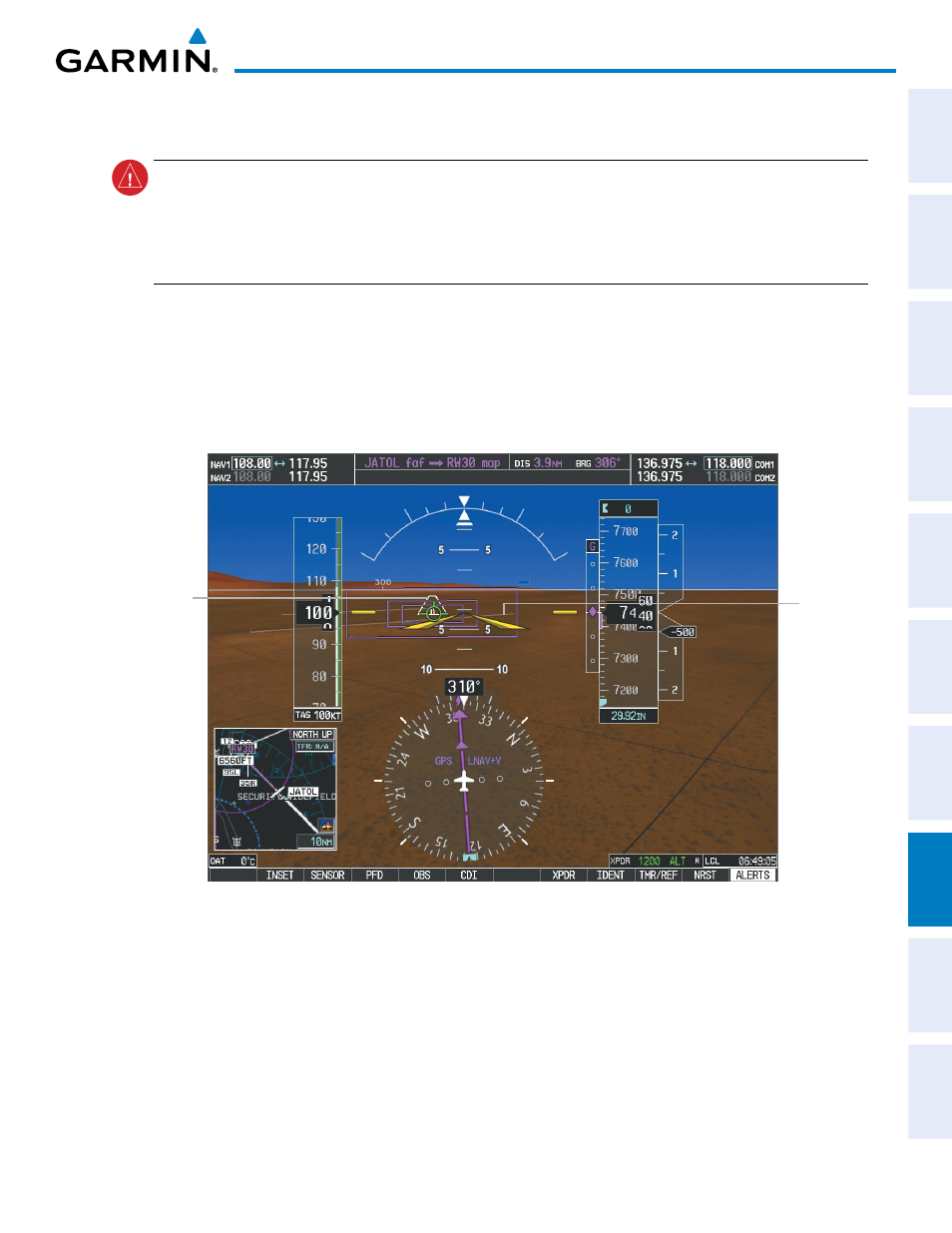
RUNWAYS
WARNING:
Do not use SVS runway depiction as the sole means for determining the proximity of the aircraft
to the runway or for maintaining the proper approach path angle during landing. Runways are depicted
at the published field elevation for the selected airport. In some rare cases, actual runway elevation differs
significantly from the airport field elevation causing SVS runways to appear higher or lower than the actual
runway.
Runway data provides improved awareness of runway location with respect to the surrounding terrain. All
runways displayed for a given airport are shown at the published airport elevation. As runways are displayed,
those within 45 degrees of the aircraft heading are displayed in white. Other runways will be gray in color.
When an approach for a specific runway is active, that runway will appear brighter and be outlined with a
white box, regardless of the runway orientation as related to aircraft heading. As the aircraft gets closer to the
runway, more detail such as runway numbers and centerlines will be displayed.
Other
Runway
on Airport
Figure 8-9 Airport Runways
Runway
Selected for
Approach