Flight management – Garmin G1000 Quest Kodiak User Manual
Page 180
Garmin G1000 Pilot’s Guide for the Quest Kodiak 100
190-00590-01 Rev. B
168
FLIGHT MANAGEMENT
SY
STEM
O
VER
VIEW
FLIGHT
INSTRUMENTS
EIS
AUDIO P
ANEL
& CNS
FLIGHT
MANA
GEMENT
HAZARD
AV
OID
ANCE
AFCS
ADDITIONAL FEA
TURES
APPENDICES
INDEX
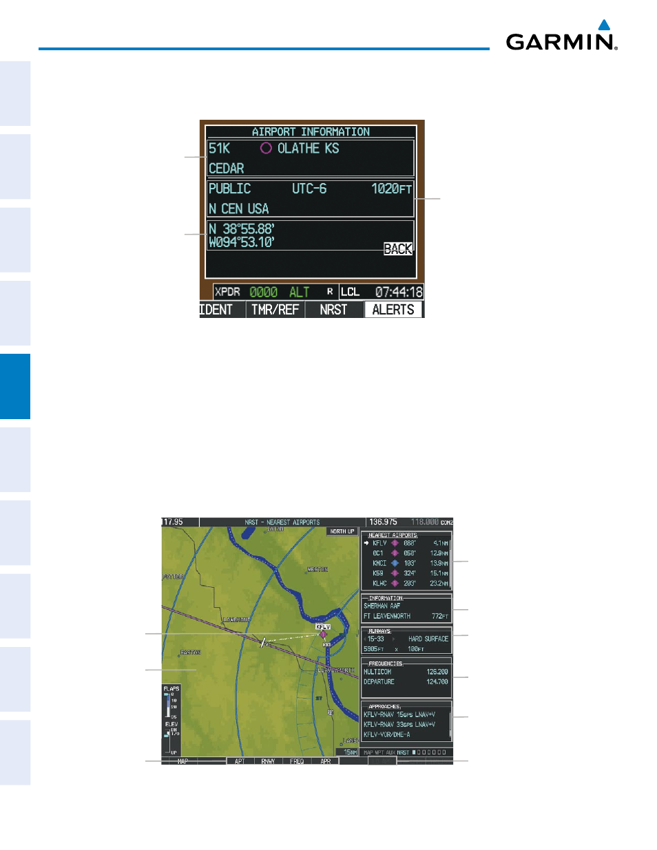
Continued presses of the ENT Key sequences through the information pages for all airports in the Nearest
Airports list.
Figure 5-34 Airport Information Window on PFD
Airport Information
- Usage/Time/Elev
- Region
Airport Information
- Lat/Long
Airport Information
- ID/Type/City
- Facility
The Nearest Airports Page on the MFD is first in the group of NRST pages because of its potential use in
the event of an in-flight emergency. In addition to displaying a map of the currently selected airport and
surrounding area, the page displays nearest airport information in five boxes labeled ‘NEAREST AIRPORTS’,
‘INFORMATION’, ‘RUNWAYS’, ‘FREQUENCIES’, and ‘APPROACHES’.
The selected airport is indicated by a white arrow, and a dashed white line is drawn on the navigation map
from the aircraft position to the nearest airport. Up to five nearest airports, one runway, up to three frequencies,
and up to three approaches are visible at one time. If there are more than can be shown, each list can be scrolled.
If there are no items for display in a boxed area, text indicating that fact is displayed. The currently selected
airport remains in the list until it is unselected.
Figure 5-35 Nearest Airport Page
Nearest Airport
Navigation Map
Showing Nearest
Airport
Runway Information
- Designation/Surface
- Length/Width
Nearest Airports
- ID/Type
- Bearing/Distance
COM/NAV Freq. Info.
- Identification
- Frequency
Window Selection
Softkeys
Airport Information
- Facility/City/Elevation
Approaches Available
LD APR Softkey (only
available if an approach is
highlighted)