Displaying traffic data, Hazard avoidance – Garmin G1000 Mooney M20TN User Manual
Page 328
190-00647-01 Rev. B
Garmin G1000 Pilot’s Guide for the Mooney M20M/M20R/M20TN
317
HAZARD AVOIDANCE
SY
STEM
O
VER
VIEW
FLIGHT
INSTRUMENTS
EIS
AUDIO P
ANEL
& CNS
FLIGHT
MANA
GEMENT
HAZARD
AV
OID
ANCE
AFCS
ADDITIONAL
FEA
TURES
APPENDICES
INDEX
DISPLAYING TRAFFIC DATA
Traffic information can be displayed on the following maps (when TIS is operating):
• PFD Inset Map
• Navigation Map Page
• Traffic Map Page
• Trip Planning Page
• Nearest Pages
• Active Flight Plan Page
Displaying traffic information (maps other than the Traffic Map Page):
1)
Press the MAP Softkey.
2)
Press the TRAFFIC Softkey.
When traffic is selected on maps other than the Traffic Map Page, an icon is shown to indicate the feature is
enabled for display.
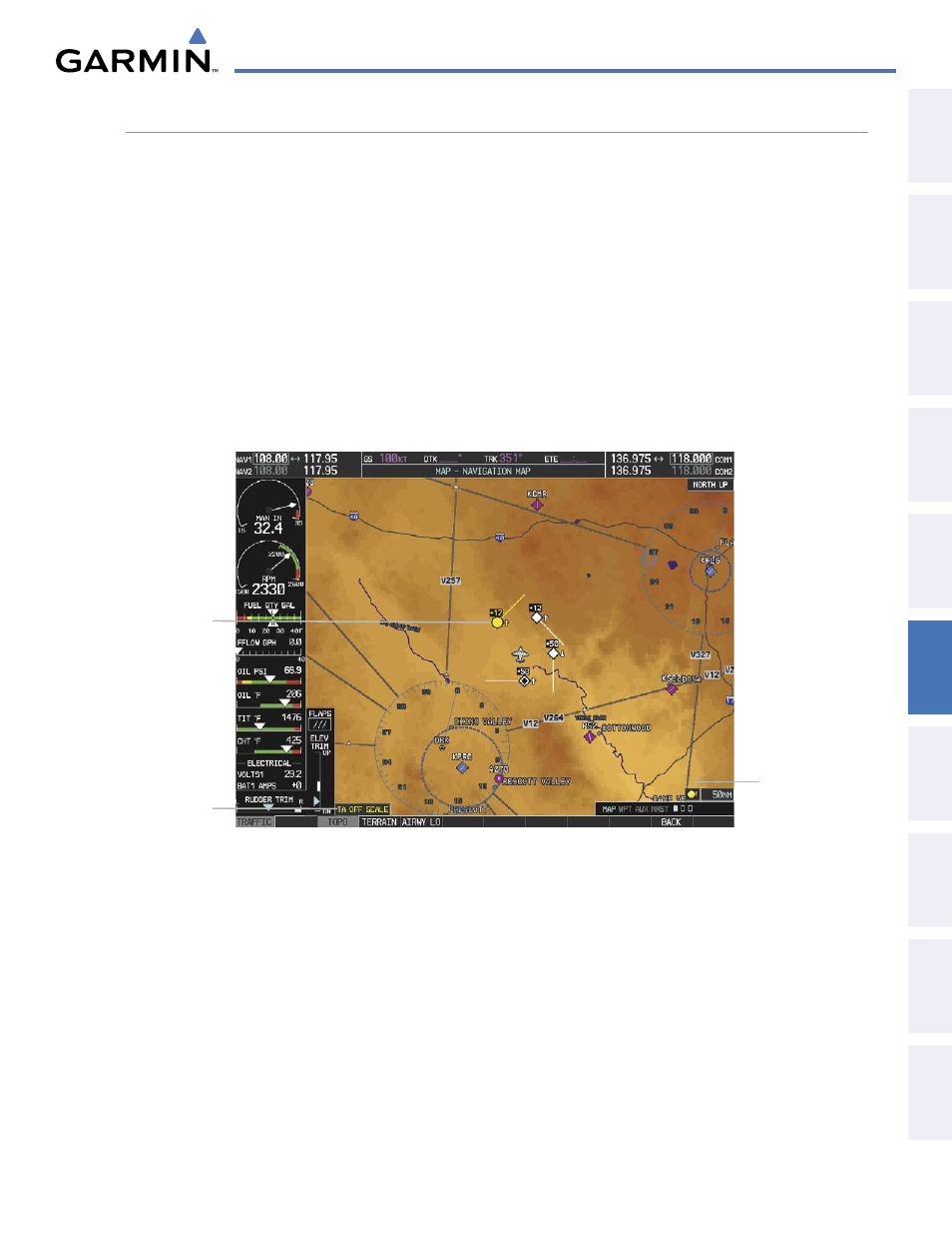
Figure 6-64 TIS Traffic on the Navigation Map Page
Traffic Advisory
Traffic Status
Banner
Traffic Display
Enabled
Displaying traffic information (PFD Inset Map):
1)
Press the INSET Softkey.
2)
Press the TRAFFIC Softkey to display traffic data on the inset map (TRFC-1).
3)
Press the softkey again to display the traffic-only inset (TRFC-2).
4)
Press the softkey again to remove traffic data.
The Navigation Map Page Setup Menu provides a means in addition to the softkey for enabling/disabling
display of traffic. The setup menu also controls the map range settings above which traffic data (symbols
and labels) are decluttered from the display. If a map range larger than the map range setting is selected, the
data is removed from the map. Maps besides the Traffic Map Page use settings based on those selected for the
Navigation Map Page.