Hazard avoidance, Surface analysis and city forecast – Garmin G1000 Mooney M20TN User Manual
Page 300
190-00647-01 Rev. B
Garmin G1000 Pilot’s Guide for the Mooney M20M/M20R/M20TN
289
HAZARD AVOIDANCE
SY
STEM
O
VER
VIEW
FLIGHT
INSTRUMENTS
EIS
AUDIO P
ANEL
& CNS
FLIGHT
MANA
GEMENT
HAZARD
AV
OID
ANCE
AFCS
ADDITIONAL
FEA
TURES
APPENDICES
INDEX
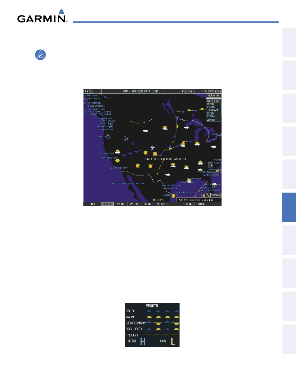
SURFACE ANALYSIS AND CITY FORECAST
NOTE:
Surface Analysis and City Forecast data are displayed only within the installed Aviation Database
service area.
Surface Analysis and City Forecast information is available for current and forecast weather conditions.
Forecasts are available for intervals of 12, 24, 36, and 48 hours.
Figure 6-28 Current Surface Analysis Data
Displaying Surface Analysis and City Forecast information:
1)
Select the Weather Data Link Page.
2)
Press the MORE WX Softkey.
3)
Press the SFC Softkey.
4)
Select the desired forecast time: CURRENT, 12 HR, 24 HR, 36 HR, or 48 HR. The SFC Softkey label changes
to reflect the forecast time selected.
To display the Surface Analysis and City Forecast legend (Figure 2-29), press the LEGEND Softkey when
Surface Analysis and City Forecast are selected to be displayed.
Figure 6-29 Surface Analysis Legend