Appendix f miscellaneous, Hazard avoidance features – Garmin G1000 Quest Kodiak User Manual
Page 494
190-00590-03 Rev. A
Garmin G1000 Pilot’s Guide for the Quest KODIAK 100
SY
STEM
O
VER
VIEW
FLIGHT
INSTRUMENTS
EIS
AUDIO P
ANEL
& CNS
FLIGHT
MANA
GEMENT
HAZARD
AV
OID
ANCE
AFCS
ADDITIONAL FEA
TURES
APPENDICES
INDEX
482
APPENDIX F
MISCELLANEOUS
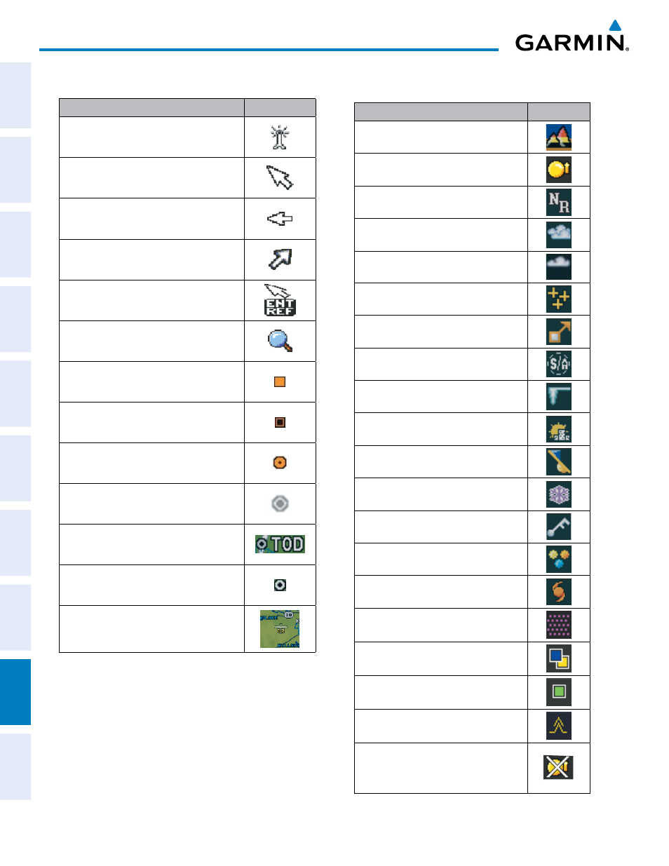
Item
Symbol
ARTCC Frequency or FSS Frequency
Default Map Pointer
Elevation Pointer
Wind Vector
Measuring Pointer
Overzoom Indicator
User Waypoint
Vertical Navigation Along Track Waypoint
Parallel Track Waypoint
Unanchored Flight Path Waypoint
Top of Descent (TOD)
Bottom of Descent (BOD)
Navigating using Dead Reckoning
HAZARD AVOIDANCE FEATURES
Feature
Symbol
Terrain Proximity/TAWS display enabled
Traffic display enabled
NEXRAD display enabled
Cloud Top display enabled
Echo Top display enabled
XM Lightning display enabled
Cell Movement display enabled
SIGMETs/AIRMETs display enabled
METARs display enabled
City Forecast display enabled
Surface Analysis display enabled
Freezing Levels display enabled
Winds Aloft display enabled
County Warnings display enabled
Cyclone Warnings display enabled
Icing Potential (CIP and SLD) (ICNG)
Pilot Weather Report (PIREPs)
Air Report (AIREPs)
Turbulence (TURB)
Loss of hazard avoidance feature, (a
white X is shown over the symbol to
indicate not available; e.g., traffic)