Nielsen-Kellerman ClearNav User Manual
Page 79
NK ClearNav Manual • Version 0.5 • July 3, 2008
Page 79 of 86
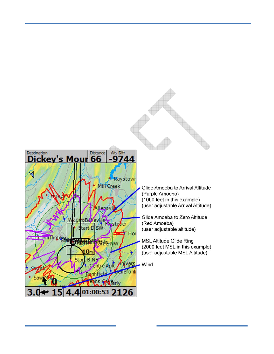
4.2.6 MSL Altitude Glide Ring
The MSL Altitude Glide Ring can be displayed on the map to show how far you can glide descending
down to the user selected MSL Altitude. This option is a neat idea, but we aren’t sure yet how useful it
will be. If you don’t use it we recommend turning it off to limit the amount of information on the map.
In still air you can glide from your current location all the way to the MSL Altitude Glide Ring. You will
arrive at the ring at the user selected MSL Altitude. The ring will only display when the glider is at an
altitude that is higher than the user selected MSL Altitude entered for the MSL Altitude Glide Ring. As
you increase the number entered in the MSL Altitude the ring will get closer to the glider because the
difference in altitude will get smaller.
The MSL Altitude Glide Ring may be useful is when trying to overfly an airspace region. For example, if
there is airspace nearby that has a ceiling of 3000 feet MSL, you could set the MSL Altitude Glide Ring
to 3000 feet (or 3200 feet to be conservative). If the airspace you want to fly over is completely inside
the MSL Altitude Glide Ring then you know that you can glide over it. If the airspace region extends
beyond the MSL Altitude Glide Ring then you know that you can’t make it all the way across the
airspace region without descending down into it.