Clarion NX501 User Manual
Page 83
15
NX501/NZ501 English
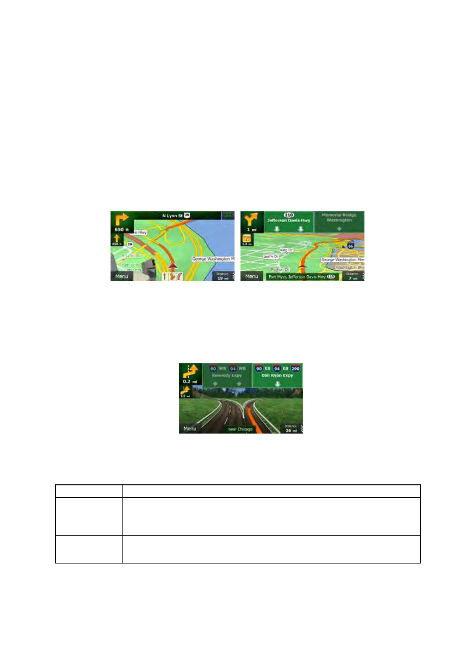
2.2.3.3 Lane information and Signposts
When
navigating on multilane roads, it is important to take the appropriate lane in order to follow the
recommended
route. If lane information is available in the map data, Clarion Mobile Map displays the
lanes
and their directions using small arrows at the bottom of the map. Highlighted arrows represent the
lanes
you need to take.
Where
additional information is available, signposts substitute arrows. Signposts are displayed at the top
of
the map. The color and style of the signposts are similar to the real ones you can see above road or by
the
roadside. They show the available destinations and the number of the road the lane leads to.
All
signposts look similar when cruising (when there is no recommended route). When navigating a route,
only
the signpost that points to the lane(s) to be taken is displayed in vivid colors; all others are darker.
If
you want to hide the currently displayed signposts, tap any of them and the normal Map screen returns
until
new signpost information is received.
2.2.3.4 Junction view
If
you are approaching a freeway exit or a complex intersection and the needed information exists, the
map
is replaced with a 3D view of the junction. The lanes you need to take are displayed with arrows.
Signposts
can also be present if information is available.
If
you want to hide the currently displayed junction, tap the picture and the Map screen returns.
2.2.3.5 3D object types
Clarion
Mobile Map supports the following 3D object types:
Type
Description
3D
terrain
3D
terrain map data shows changes in terrain, elevations or depressions in the land
when
you view the map in 2D, and use it to plot the route map in 3D when you
navigate.
Hills and mountains are shown in the background of the 3D map, and
illustrated
by color and shading on the 2D map.
Elevated
roads
Complex
intersections and vertically isolated roads (such as overpasses or bridges)
are
displayed in 3D.