GME G142CFD User Manual
Page 32
G - C O M B O
I N S T R U C T I O N M A N UA L
PA G E 3 3
4-1-1 Language
Change the language for menus and data screens.
4-1-2 Beep volume
Select the volume level of beep.
4-1-3 Auto power
See section 3-1.
4-1-4 Features
When external devices are connected to the unit, the
corresponding options need to be set.
4-1-5 Factory reset
When this option is selected. All settings of the unit return to
default factory settings.
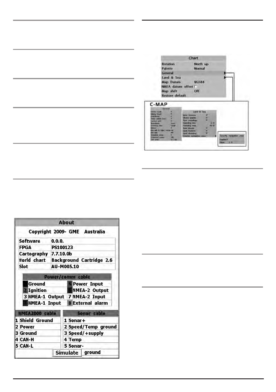
4-1-6 About
The About window shows:
1 Software version and release date.
2 C-Map version.
3 Wiring information.
4-2 Chart Settings
To go to the chart settings:
1 Press and hold MENU .
2 Select the Chart icon.
4-2-1 Rotation
Three types of display presentations are provided. The default
is heading up.
North up: North is at the top of the display.
Heading up: When course is set, the heading is to the top of
screen at all times.
Course up: When a course is set it this will be to the top
of the screen. This option is only available when you are
navigating to a waypoint or following a route.
4-2-2 Palette
Palettes are used to enhance the visibility of the display
depending on the surrounding light environments. Four types
of displays are provided; Normal, NOAA, Sunlight and Night.
4-2-3 General (C-MAP)
Plotter mode: This mode allows you to zoom in and out at
scales where cartographic data is not available (over zoom).
Mixing levels: When the map coverage of the current chart
scale does not fill the entire display, the GPS chartplotter draws
the rest of map using charts from above and below the current
scale. When this function is turned on you will notice the
display may redraw 2 to 3 times to show all the detail.
AntiClutter: when this option is selected, less important
information (names and icons) are hidden when they overlap
on the chart.