GME G142CFD User Manual
Page 15
PA G E 1 6
I N S T R U C T I O N M A N UA L
G - C O M B O
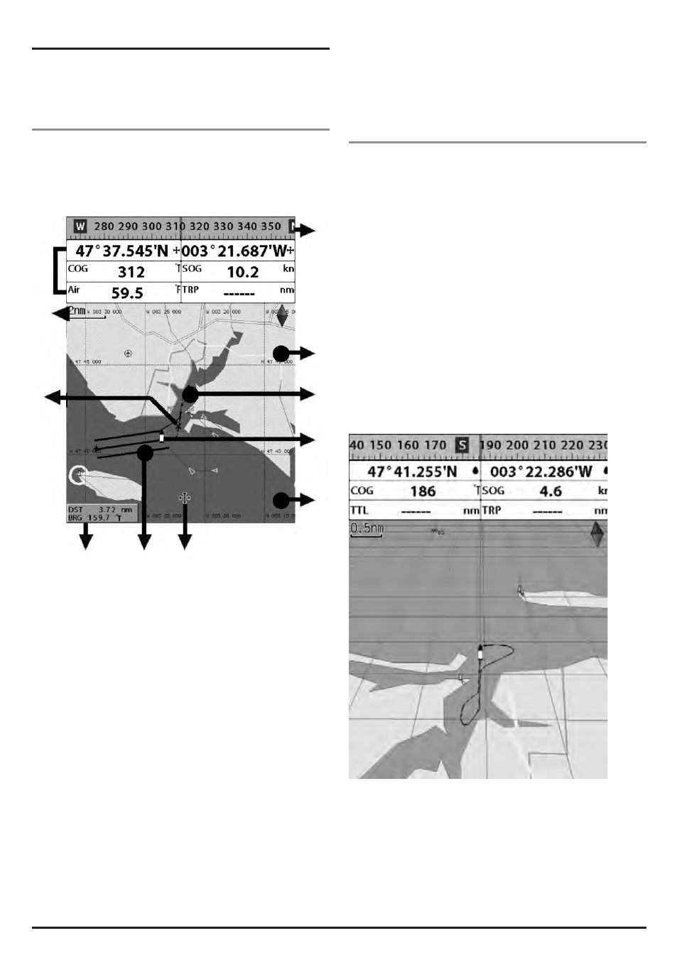
3-4 Chart
The Chart window shows relevant navigation data available
on your preloaded maps, including buoys, lights, cables, depth
soundings, marinas, and tide station from an overhead view.
3-4-1 Chart window
To go to the Chart window:
• Press PAGE and select Chart icon by pressing ENT.
A typical Chart window shows:
1 Data bar. Data can be customised.
2 Compass
3 Chart scale
4 Boat position
5 Boat track
6 Boat course and CDI lines
7 Distance and bearing of cursor from boat
8 Land
9 Sea
10 The cursor
11 A typical waypoint
The built-in world chart does not show enough detail
for navigation. When you use the Chartplotter to
navigate, always use a chart card which covers the
region. (C-MAP).
3-4-2 Perspective view
With a C-Map chart inserted, chart data may be projected
in perspective mode during navigation. This function allows
setting the panoramic view of the chart. As the upper side of
the map is more compressed than the lower side, a wider map
area is visible.
The perspective view allows more chart information to be seen
immediately ahead and close to the cursor.
To activate this function follow the procedure:
1 Press MENU.
2 Select Perspective.
1
3
11
7
6
10
9
4
5
8
2