Record a levee track, Set a - b lines – John Deere SURFACE WATER PRO OMPFP11362 User Manual
Page 48
Levee
JS56696,00009EC 1916MAY112/2
JS56696,00009ED 1916MAY111/1
PC13745
—UN—16MA
Y1
1
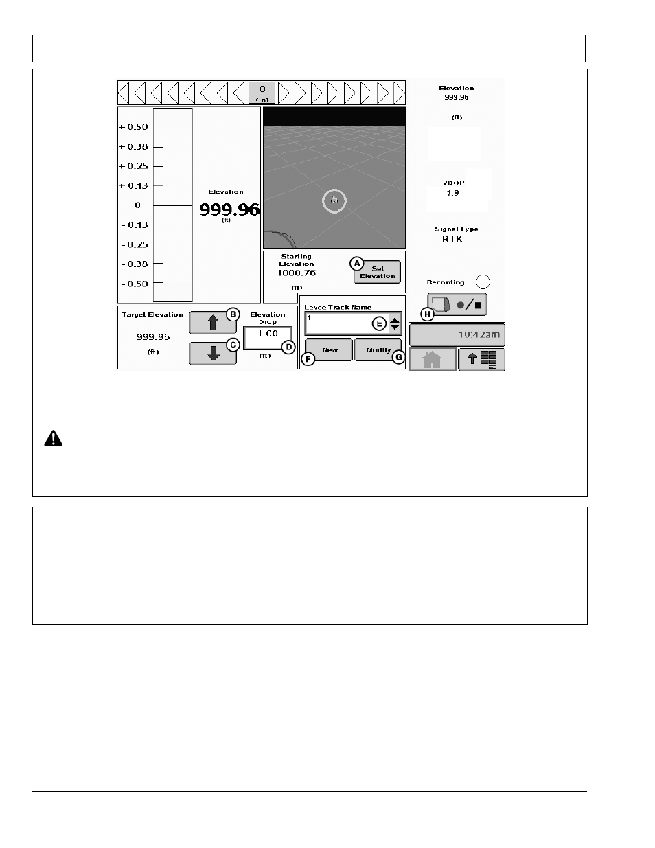
Home Page set up to show Dial and Map view
A—Set Elevation button
B—Increase Elevation button
C—Decrease Elevation button
D—Elevation Drop input box
E—Levee Track Name dropdown
F— New Levee Track Name
button
G—Modify Levee Track Name
button
H—Record button
CAUTION: While using elevation dial, remain alert
and pay attention to surrounding environment.
Drive along and mark a constant elevation line using
elevation dial (Driving the Dial).
After the levee has been marked for that elevation, select
either up (B) or down (C) arrow to set target elevation for
the next levee at either a higher (up arrow) or lower (down
arrow) elevation.
Record a Levee Track
After making the levee with the dial, turn the vehicle
around.
1. Select NEW button. The system autoincrements the
names by numbers beginning at 1.
2. Set A.
3. Record the levee track by driving back over your wheel
tracks in the soil that you created with the dial.
4. At the end of the track, select B.
5. The name appears in the list.
455
061611
PN=48