DeLorme PN-20 User Manual
Page 32
31
well as the total distance from the last measurement node to the first measurement node. It
displays the area once you close a polygon.
Note: Lines must contain at least two points. To make a polygon, you must close the shape
by placing the last point on top of the first point. Hovering the cursor over the start location
snaps to the point and closes the object when you press ENTER to commit the point.
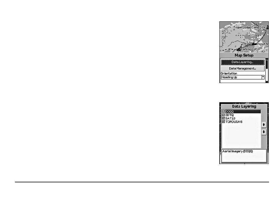
To Set Up the Map
Use the Map Setup option to customize the map by defining data type layering, showing/hiding map
packages, and choosing map orientation, POI detail, how waypoints display on the map, and scale.
Layering Your Data
You can use the Data Layering menu option to prioritize the order in which to display the many
different data types available for use on the Earthmate GPS PN-20. Data layers at the top of the list
display first when available. For example, if you have DeLorme Topographic Data and Aerial Imag-
ery (DOQQ) coverage for the same area, the data type with the highest priority displays on the map
based on the default Data Layering settings. The default order is as follows:
1. Draw Layers
2. Custom Raster (XMap® only)
3. ImageReg (XMap only)
4. High-resolution Cities
5. Color Aerial Imagery
6. Aerial Imagery (DOQQ)
7. USGS Quads (3DTQ)
8. NOAA Nautical Charts
9. Satellite Imagery
10. Custom Vector (XMap only)
11. DeLorme Topographic Data
12 Base Map
The Map Page
Data Layering menu options
Map Setup menu options