The map page – DeLorme PN-20 User Manual
Page 24
23
The Map Page
Viewing the Map Page
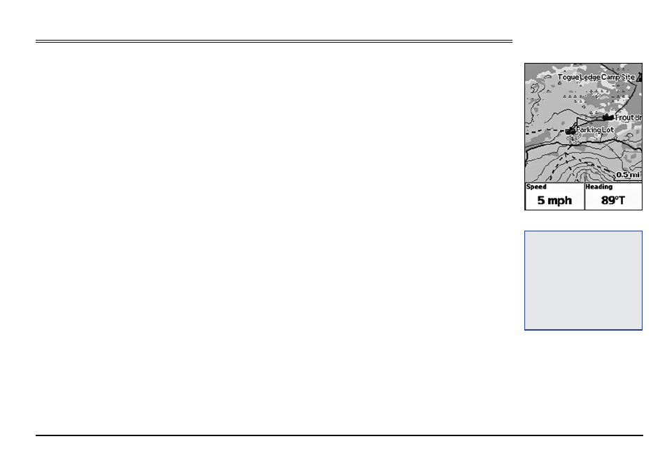
If a 2-D or 3-D fix is obtained, the Map Page displays the map data that is available for your current
GPS location. If a GPS fix cannot be obtained, the location of your last GPS fix displays on the map.
The color of the GPS arrow depends on your GPS signal.
• A flashing red arrow indicates that the Earthmate GPS PN-20 cannot obtain a GPS signal.
• A blue arrow indicates that the device is in Track Playback mode or Simulate Navigation mode.
• A yellow arrow indicates a 2-D fix.
• A green arrow indicates a 3-D fix.
Below the map are information fields. The information displayed in these fields varies based on the
selections you choose (for more information, see To Change the Information Fields on page 25).
The scale is located above the information fields. A north arrow is also available in the upper-right
corner of the screen; this is available only when Heading Up is selected as the map orientation (or
Course Up is selected when navigating). Note: Raster maps rotate in 90° headings.
To View Map Data
The Earthmate GPS PN-20 comes standard with a base map showing high-level world and U.S.
coverage. You cannot remove the base map from memory.
Several data types are compatible with the Earthmate GPS PN-20:
• High-resolution Cities
• Color Aerial Imagery
• Aerial Imagery (DOQQ)
• USGS Quads (3DTQ)
• NOAA Nautical Charts
• Satellite Imagery
• DeLorme Topographic Data
• World base data
Tip:
You can also choose to
hide the information fields to
make the map area larger (for
more information, see To Hide
the Information Fields on page
24) or change the number of
information fields that display
(for more information, see To
Arrange the Information Fields
on page 24).
Map Page
The Map Page