5 the hsi screen – AvMap EKPIV series User Manual
Page 38
38
5 the hSI SCReen
The HSI screen presents the desired course to be flown and the current Track in a graphical format
similar to the Horizontal Situation Indicator of an aircraft; using the compass rose as the center of
the display. From Moving Map:
> ‘MENU’ 1 sec. + “HSI SCREEN” + ‘ENTER’
5.1 hSI deSCRIPtIon
The HSI calculates user data (current Flight Plan and VNAV calculator data) with GPS data to
provide the visual display of the parameters of flight. While flying with the HSI mode, the Heading
Index and Course Indicator guide you to your destination.
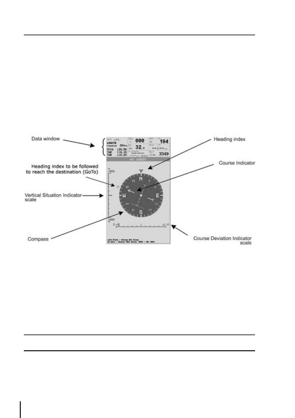
Fig. 5.1 - HSI screen
The Vertical Situation Indicator (VSI) scale is displayed on the left side of the screen (rounded to the
nearest 100ft/min or 0.5 m/sec), while the Course Deviation Indicator (CDI) scale is displayed at the
bottom of the screen. Use the cursor keys up/down to change VSI scale among 50, 500 and 1000
FT. Use the cursor key left/right to change CDI scale among 0.1, 0.5, 1, , 5 and 10 NM.
The units of measure are selected from Units Setup in the System Setup Menu, (refer to Chapter
14).
Note
When the XTE is greater than the full scale indication, the deviation bar of the ruler changed with a ‘>’ or ‘<’
sign to display an “out of scale” condition.
5.2 hSI MenU
When on the HSI screen, pressing ‘MENU’ will access the HSI Menu with the following options:
Add Mark under Fix, Setup Data Fields, Default Data Fields and Compass Orientation.