5 default datafields, 6 map orientation, 7 map presentation menu – AvMap EKPIV series User Manual
Page 29
9
3.5.5 default datafields
This will restore data fields settings to default values
> ‘MENU’ + “DEFAULT DATA FIELDS” + ‘ENTER’
The message “DONE” will appear to the right confirming the action is complete. The Default Fields
will only be applied to the currently selected Data Window Option; i.e. 1-Line, -Lines, etc. .
3.5.6 Map orientation
Map Orientation controls the direction that the Moving Map is pointing during Home and Auto
Zoom modes.
> ‘MENU’ + “MAP ORIENTATION” + ‘ENTER’
The options are:
track-up
- will rotate the map automatically to keep your Track pointed toward the top of the
display (see Par. 14..6; System Setup + Fix Setup + Head Up Response).
Course-up
- will rotate the map automatically to keep your active leg pointed toward the top of
the display.
north-up
- will rotate the map automatically to keep North pointing toward the top of the display.
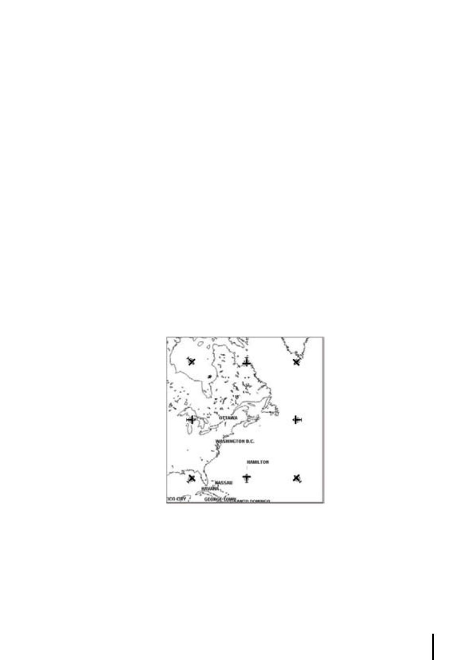
during north
- up mode the Screen Amplifier is active. Depending on the Heading, the fix icon
is placed on one of the 8 positions. For example, if the Heading is 45°, the fix icon is placed on
the bottom left part of the screen (see Fig. 3.5.5). This method of icon placement allows for the
maximum view ahead of the aircraft at the given direction of travel.
The default map orientation is set to TRACK-UP.
Fig. 3.5.6 - 8 marks at the areas where the icon may appear
If there is no Course defined, then COURSE UP mode NOT ALLOWED; if already in COURSE UP
mode with a destination, and DEACTIVATING it, then mode reverts to NORTH UP mode.
3.5.7 Map Presentation Menu
The Map Presentation Menu enables the user to switch quickly among several map presentation
modes: plain Land Elevation, TAWS and Weather (North America only).