Stop & go indicator, Stop & go indicator satellite status, continued – Leica Geosystems GPS System 500 - Getting Started with Static and Kinematic Surveys User Manual
Page 25
25
Static and Kinematic Surveys-2.0.0en
Exploring the sensor status during operation
6
7
8
9
13
23
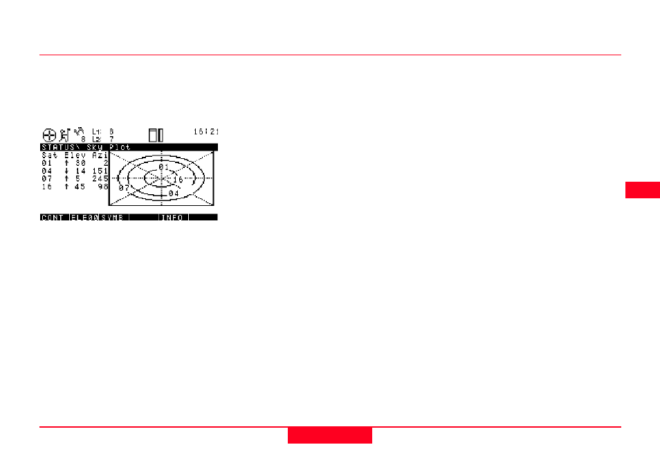
The center of the graph represents
the Zenith, the circles represent lines
of equal elevation: 15 degree - 30
degree - 60 degree (from outside to
inside).
Stop & Go indicator
Satellite status, continued
Press F1 CONT to get back to the
STATUS \ Satellite screen.
Press F1 again to exit the STATUS
menu and return directly to the
screen from where STATUS was
called. The same can be achieved by
pressing ESC several times; this
brings you back step by step until you
will also end up at the screen from
which STATUS was initially called.
Press F5 SKY to get a skyplot
representing the position of each
satellite with respect to the Zenith
and North:
The Stop & Go indicator helps users
to judge the necessary site
occupation time for rapid static
measurements for sensors used as
rovers.
A minimum site occupation time is
calculated depending on various
parameters such as:
- The number of currently tracked
satellites
- The current satellite geometry
(represented as GDOP)
- Number of cycle slips
- The assumed baseline length
between the reference site.
- The current rover position.