Telenav for Nextel Supported Devices: v2.2.5 for Motorola i830 User Manual
Page 14
© TELENAV 2003-5
PAGE 14 OF 39
Compass
Mark waypoint
View waypoint
Record track
View track
GPS basic
OK BACK
Compass
If you select Compass from the submenu, you will see a lower level menu with the options of View
Compass, and Sats in View.
View compass
Sats in view
Compass
OK BACK
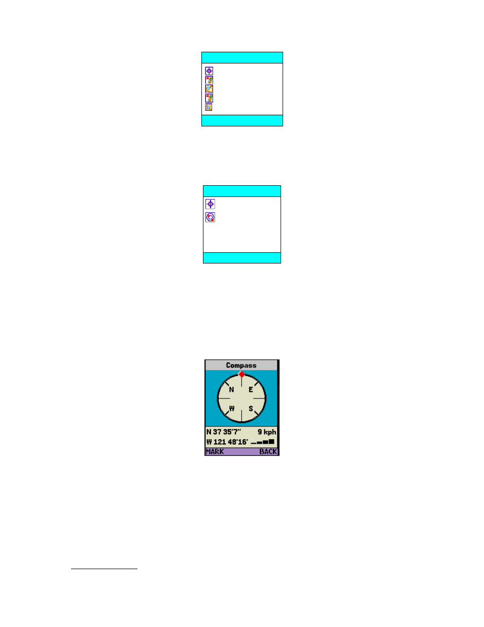
View Compass
If you choose View Compass, you will see a display similar to a nautical compass, but more correctly it
actually displays course over ground, the direction you are traveling. Unlike a real compass, you have
to be moving to determine course over ground. The screen also provides current latitude, longitude,
and speed. Using the main menu Preferences, you can select the format of the latitude and longitude
as degrees, minutes, and seconds; or decimal degrees; and you can select the format of the speed as
miles per hour or kilometers per hour. Press BACK to return to the GPS basic submenu.
If no GPS data is available, “No GPS” appears instead of latitude and longitude. Otherwise, a GPS
satellite count indicator occupies the area below the speed value. Add three (3) to the number of bars
shown to determine the number of satellites being tracked by the GPS receiver. When the indicator
shows that 7 satellites are being tracked (which is good), the receiver may actually be tracking even
more (which is even better).
If you have started recording a track, the portion of the above display where the speed is shown is
overwritten with “track” on a red background to indicate that you are in the process of recording your
location every few minutes.
Marking a Waypoint. The left MARK Option Key allows you to mark a waypoint (as described below)
directly from the Compass view.