BendixKing KLN 89B - Pilots Guide User Manual
Page 144
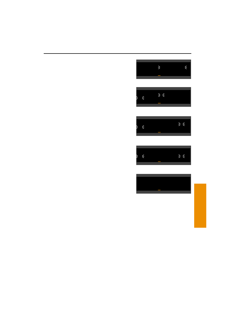
5.
Press
F
. The display will
change to a format like
figure 4-107.
6.
Use the right inner knob to select
N for north or S for south
(figure 4-108).
7.
Use the right outer knob to move
the cursor, and the right inner
knob to select the proper
numbers to complete the latitude
entry (figure 4-109).
8.
Press
F
. The cursor will move
to the longitude field.
9.
Enter the longitude in the same
manner as the latitude
(figure 4-110).
10. Press
F
to approve this
position. The cursor will
automatically turn off
(figure 4-111).
4.6.3.
CREATING A WAYPOINT REFERENCED FROM
ANOTHER WAYPOINT
The third method of creating a user-defined waypoint is as a radial
and distance from a known waypoint.
To create a user-defined waypoint using the radial/distance
method:
1.
From any user waypoint (USR) page, turn on the cursor (
B
). It
will flash over the first character in the waypoint identifier field.
2.
Use the right inner knob to select the first character of the
identifier. Remember that when the cursor is on, the right inner
KLN 89/KLN 89B Pilot’s Guide
Advanced GPS Operation
4-33
Advanced GPS Operation
Chapter 4
APT VOR NDB INT USR ACT NAV FPL CAL SET OTH
åå.ånm| FARM«
ееееее| N 42°56.32'
# Leg| W 76°29.95'
*CRSR*|>---°To ----nm
Figure 4-110
APT VOR NDB INT USR ACT NAV FPL CAL SET OTH
åå.ånm| FARM«
ееееее| N 42°56.32'
Leg| W 76°29.95'
USR 1 |>035°To 6.7nm
Figure 4-111
APT VOR NDB INT USR ACT NAV FPL CAL SET OTH
åå.ånm| FARM«
ееееее| _ __°__.__'
Leg| ____°__.__'
*CRSR*|>---°To ----nm
Figure 4-107
APT VOR NDB INT USR ACT NAV FPL CAL SET OTH
åå.ånm| FARM«
ееееее|
N __°__.__'
# Leg| ____°__.__'
*CRSR*|>---°To ----nm
Figure 4-108
APT VOR NDB INT USR ACT NAV FPL CAL SET OTH
åå.ånm| FARM«
ееееее| N 42°56.32'
# Leg| ____°__.__'
*CRSR*|>---°To ----nm
Figure 4-109