Ez-guide, 250 lightbar guidance system ez-guide, 250 lightbar guidance system quick reference card – Ag Leader EZ-Guide 250 Quick Reference Guide User Manual
Page 5: Mapping, Map screens, Nudge, Shift to here
EZ-GUIDE
®
250
LIGHTBAR GUIDANCE SYSTEM
EZ-GUIDE
®
250 LIGHTBAR GUIDANCE
SYSTEM QUICk REFERENCE CARD
Mapping
To enter mapping mode, select the
icon
and press OK. Mapping is only available in
Advanced Mode.
While in mapping mode, you can:
• map point, line and area features, including
exclusion zones
• engage and disengage EZ−Steer
®
Note: Mapping is disabled if you do not
have good quality GPS.
Mapped features are saved with the field. To
see mapped features when you return to a
field, reload the field and start a new event or
continue with an existing event.
To configure mapping options, including warning
zone distance, recording position, deleting
features, select Configuration / Mapping.
To map a point feature, select
and then one
of the following icons:
Rock
Tree
Weed
Generic Point
To map a line feature, select
then:
Generic Line
To map an area feature, select
and then one
of the following icons:
Generic Area
Exclusion Zone
To delete the closest feature, select the
delete icon:
Delete
By default, the view automatically
switches to the perspective view when you
enter a field. To set the view so it switches
when you engage an autosteering system
or for manual view control, in Advanced
mode select Configuration / System /
Display / View.
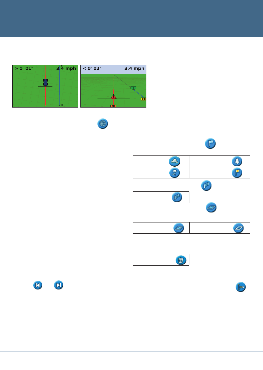
Map Screens
Plan View
Perspective View
Nudge
Use the
and
nudge buttons to correct
for position drift caused by GPS satellite
constellation changes while driving in the field.
Nudge is always applied to the guidance line
relative to the vehicle heading. The total current
nudge distance appears on the tip bar at the
bottom of the screen.
To configure the nudge options, in Advanced
mode, select Configuration / System /
Guidance.
Shift to Here
In Advanced mode, you can use Shift to Here
to:
• Correct for GPS position drift when
returning to the field for guidance, for
example after pausing
• Offset all swaths for applications in
subsequent years
You can save the shifted swaths, which nudge
does not allow.