Garmin GPS 400 User Manual
Page 43
GPS 400 Pilot’s Guide and Reference
190-00140-60 Rev. H
SECTION 2
NAV PAGES
2-17
Inhibit Mode
TERRAIN has an inhibit mode that deactivates the
FLTA/PDA visual alerts. Pilots should use discretion when
inhibiting TERRAIN and always remember to enable
the system when appropriate. See Section 9.3 for more
information on TERRAIN alerts.
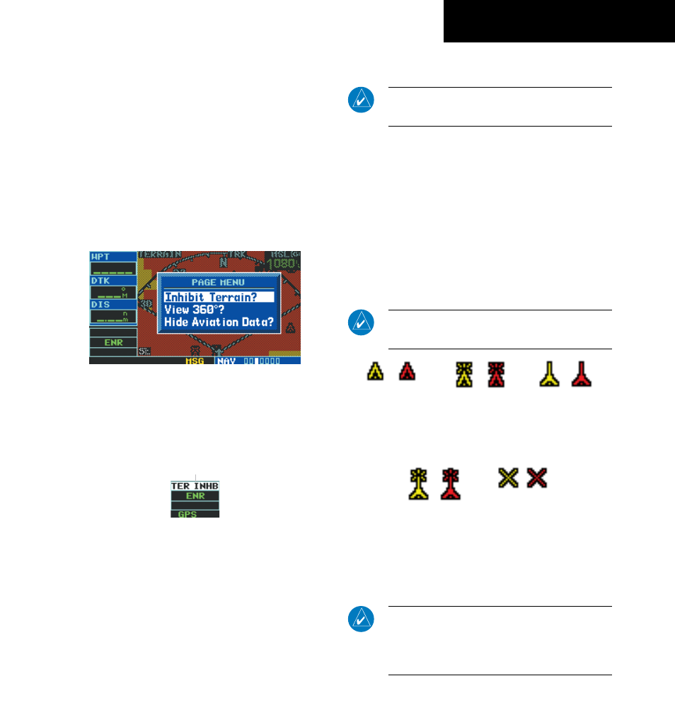
Inhibit TERRAIN:
1) Select the TERRAIN Page and press the MENU
Key. ‘Inhibit Terrain?’ is selected by default
(Figure 2-31).
Figure 2-31 TERRAIN Page Menu
2) Press the ENT Key. The ‘TER INHB’ annunciation
is displayed in the TERRAIN annunciator field
when TERRAIN is inhibited (Figure 2-32).
Annunciator Field
Figure 2-32 TERRAIN Annunciator Field
Enabling TERRAIN:
1) Select the TERRAIN Page and press the MENU
Key. ‘Enable Terrain?’ is selected by default.
2) Press the ENT Key. The TERRAIN system is
functional again.
TERRAIN Symbols
NOTe: See Section 9.2 for a complete description
of TerraiN symbology.
The following symbols (Figure 2-33) are used to
represent obstacles and potential impact points on the
TERRAIN Page.
• Red Symbol - Terrain/Obstacle is above or within
100 feet below the aircraft altitude
• Yellow Symbol - Terrain/Obstacle is between 1000
feet and 100 feet below the aircraft altitude
• Black Symbol - Terrain/Obstacle is more than
1000 feet below the aircraft altitude
NOTe: Obstacle symbols are shown on display
zoom ranges up to 10 nm.
Unlighted
Obstacles
<1000 feet AGL
Lighted
Obstacles
<1000 feet AGL
Unlighted
Obstacles
>1000 feet AGL
Lighted
Obstacles
>1000 feet AGL
Potential
Impact Points
Figure 2-33 TERRAIN Symbols
NOTe: if an obstacle and the projected flight path
of the aircraft intersect, the display automatically
zooms in to the closest potential point of impact
on the TerraiN Page.