4 airport frequency page – Garmin GPS 400 User Manual
Page 108
GPS 400 Pilot’s Guide and Reference
190-00140-60 Rev. H
6-6
SECTION 6
WPT PAGES
Adjusting the range of the map image:
1) Press the down arrow of the RNG Key to
display a smaller map area.
2) Press the up arrow of the RNG Key to display
a larger map area.
The following descriptions and abbreviations are used
on the Airport Runway Page:
• Type - Usage type: Public, Heliport, Military, or
Private
• Surface - Runway surface types include: Hard,
Turf, Sealed, Gravel, Dirt, Soft, Unknown, or
Water
• Lighting - Runway lighting types include: No
Lights, Part Time, Full Time, Unknown, or
Frequency (for pilot-controlled lighting)
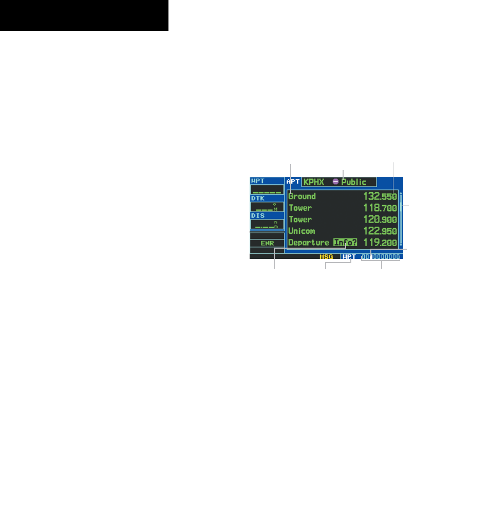
6.4 AIRPORT FREQUENCy PAGE
The Airport Frequency Page displays radio frequencies
and frequency types for the selected airport, as well as
sector and altitude restrictions (where applicable). If
the selected airport has an ILS approach, the localizer
frequency(ies) are also listed on the Airport Frequency
Page (Figure 6-12). COM and VLOC frequencies are for
reference only.
Figure 6-12 Airport Frequency Page
Airport Identifier,
Symbol, and Type
Frequency
Frequency Type
Scroll
Bar
Usage Restrictions
Information
Number of Pages in
Current Page Group
Position of
Current Page
within Current
Page Group
Current Page
Group
Scrolling through the frequency list:
1) Press the small right knob to activate the
cursor.
2) Turn the large right knob to scroll through the
list (Figure 6-13). If there are more frequencies
in the list than can be displayed on the screen,
a scroll bar (Figure 6-12) along the right-hand
side of the screen indicates the cursor’s position
within the list.