3 selective display settings – AvMap GeoPilot II Plus User Manual
Page 35
35
This calculation considers the Lowland and Highland definition, where:
A
- Lowland is the terrain under 3,000 feet of elevation
b
- Highland is the terrain over 3,000 feet of elevation
In the Lowland case, the TAWS colors will be red, yellow and green according to the following
values of the OCH:
§ red: L1= from < 0 ft. up to 500 ft.
§ Yellow: M1= from
§ Green: H1= from
§ Transparent (no color): > 2,000 ft.
In the Highland case, the TAWS colors will be red, yellow and green according to the following
rules of the OCH:
§ red: L1= from < 0 ft. up to 1,000 ft.
§ Yellow: M1= from
§ Green: H1= from
§ Transparent (no color): > 3,000 ft.
In the Auto case, the Geopilot II Plus shifts the level of the TAWS depending terrain altitudre.
In addition to the TAWS legend in the lower left corner of the screen, all vertical obstructions (i.e.
towers, tanks, etc.) will be displayed in the appropriate TAWS color scheme.
Note
If no Fix and/or no Altitude are available, TAWS legend window content is displayed with red background and
warning message “NO ALTITUDE NO TAWS AVAILABLE” .
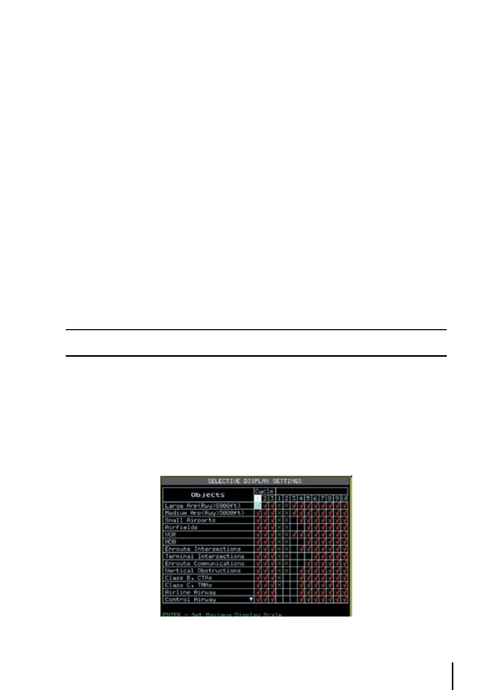
3.6.3 Selective display Settings
In addition to the above Moving Map Settings the Selective Display feature allows you to further
customize the display by selecting the chart scale level at which the category of data will begin
displaying on the map. This feature is extremely useful in decluttering the screen in populated areas
or at times when you want to focus on a single category of data, i.e. medium airports only.
> ‘MENU’ + “SELECTIVE DISPLAY...” + ‘ENT’
Fig. 3.5.12- Selective Display Settings