6 map presentation menu, 1 generic, 2 taws – AvMap GeoPilot II Plus User Manual
Page 34
34
3.6 mAP PreSenTATIon menU
The Map Presentation Menu enables the user to switch quickly among several map presentation
modes : plain Land Elevation, TAWS and Weather (North America only) . From here use the cursor
key to select the item desired and press ‘ENTER’ to activate. At any time, press ‘ESC’ to back out
of the menus and return to the Moving Map. Hold 1 sec the MENU key from the Moving Map in
order to enter the Map Presentation Menu.
3.6.1 Generic
Generic is the default presentation, the Geopilot 2 will show just land elevation if selected in the
Moving Map Menu with neither TAWS or Weather information.
3.6.2 TAWS
TAWS (Terrain Awareness Warning System), depicts the separation that exists between the terrain
and the airplane.
In order to properly display TAWS, you’ll need to configure the Geopilot II Plus. In MAP mode,
press the MENU key, select TERRAIN and press ENT. A menu is displayed. Select TAWS and confirm
by pressing ENT.
Important note
: After TAWS is enabled; TAWS will not be displayed on the map. You will need to
acquire a position fix. The simulation mode can be used for training purposes. Press the MENU key
twice and select ‘Simulator’ from the Main Menu. Press ENT, and set to “ON.”
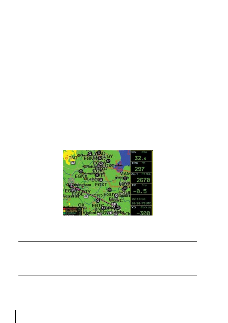
Once TAWS has been enabled, the Geopilot II Plus will display a legend in the lower left corner of
the display that depicts the TAWS color scheme:
Fig. 3.5.11.2- TAWS
Please Note
When TAWS is enabled, the color scheme is always displayed. The rules for TAWS are divided into two levels:
1. L1=500 ft. agl / M1=1,000 ft. agl / H1=2,000 ft. agl
2. L2=1,000 ft. agl / M2=2,000 ft. agl / H2=3,000 ft. agl
The TAWS rules allow you to calculate the color scheme to be used for depicting the OCH: Obstacle Clearance
Height.
The oCh
: Obstacle Clearance Height, is the difference of your own altitude (GPS Altitude) less
the Land Elevation:
OCH = ALT – LE