AvMap GEOSAT 4 TRUCK User Manual
Page 41
41
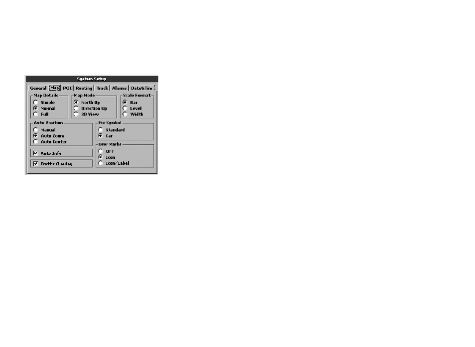
• Full
Auto position
It is possible to choose whether the zoom
level has to vary automatically during
navigation, according to speed and distance
to the next turn or whether to keep your own
GPS position centred on the map:
• Manual: once the zoom level has been set
manually, this remains constant for all the
navigation.
• Auto zoom: the zoom level is varied
automatically according to speed and
distance to next turn.
• Auto centre: the zoom level is varied
according speed.
Auto info
It activates or deactivates the automatic info
that is displayed when the cursor is placed on
any point of the map. The info box shows the
name of the street and of the objects found
near the cursor.
Traffic overlay
It activates/deactivates the windows showing
the traffic information from the TMC receiver.
The software processes, in real time, the
traffic data and displays the information in
the pre-set language. (External TMC receiver
needed)
Map mode
It sets the criteria for the map view.
• North up: the 2D map stays fixed with the
north up.
• Direction up: the 2D map rotates so that
the vehicle direction is always facing up.
• 3D View: for navigation with a GPS signal,
the map can display a 3D view (with
direction up).
Scale format
Type of scale:
• Bar: a segment proportional to the
indicated distance.
• Level: indicates the zoom level.
• Width: indicates the distance covered by
the display.
Fix symbol
You can choose which icon represents your
GPS position:
• Standard
• Car
User Marks
It sets the way Marks are displayed:
OFF: no Marks are displayed
Icon: Marks are displayed with icons
Icon/Label: Marks are displayed with icon
and name
11.4 POI
On this page, you can choose which POI
categories are displayed on the map.
To include or remove a category, select it
with the JOYSTICK and press the ENT button
to confirm.
The POIs associated to a category are
displayed when the category checkbox is
selected.
The safety cameras checkbox is activated