AvMap GEOSAT 4 TRUCK User Manual
Page 20
20
It is also possible to activate/deactivate the
walkways following the procedure described
in par. 10.5.
5.4 Navigating Off road
With Geosat it is possible to plan a route off
road.
1. Press the MENU button three times.
2. The System Set up menu will now open.
Move the JOYSTICK to the right and select
the Routing folder and press the ENT
button to confirm.
3. Select Off Road from Route preferences.
4. It is now possible to select the departure
point off-road.
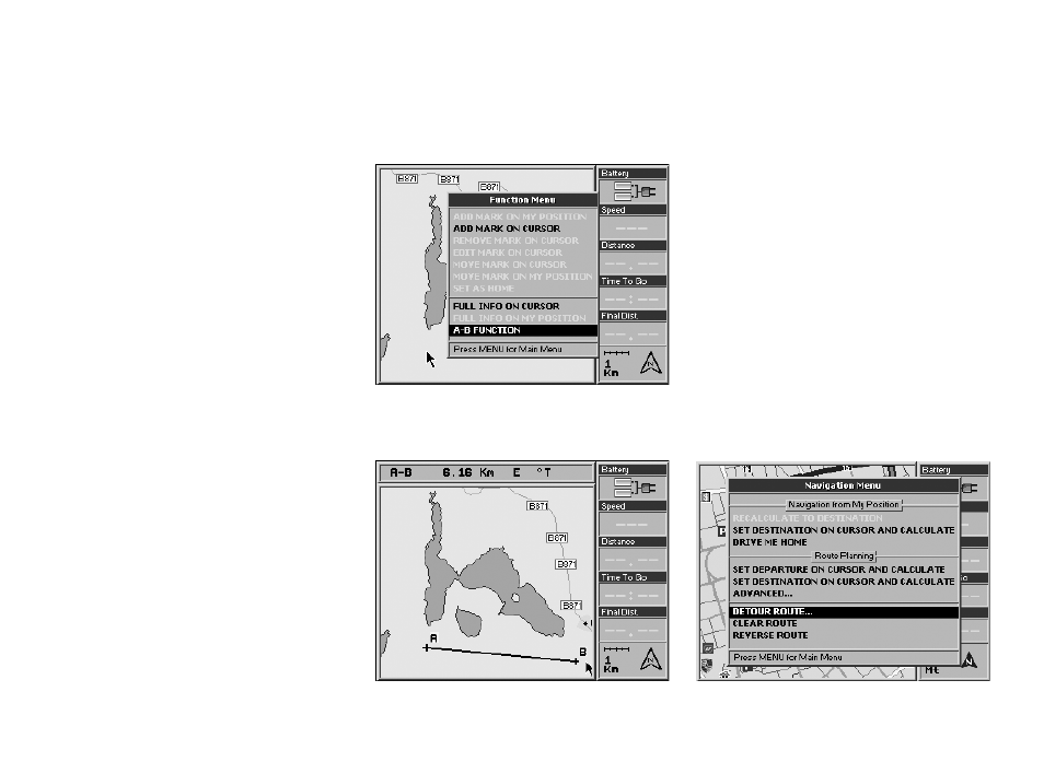
A-B Function
The A-B function is particularly useful during
off road navigation. This function allows you
to calculate the distance “as the crow flies”
between point A and B on the map:
1. Press the centre of the JOYSTICK. The
Function Menu will now open.
2. Select A-B Function and press the ENT
button to confirm. An “A” will appear in
place of the selected point on the Map.
3. Move the cursor to another point on the
map, repeat steps 1 and 2 to set the point
B.
4. A “B” will appear in place of the set point
on the Map and it will be linked to the “A”
point by means of a black line. A bar will
now open in the upper part of the display
showing the distance between A and B and
the angle from true north.
How to remove the A-B function:
1. Press the centre of the JOYSTICK. The
Function menu will now open.
2. Select Remove A-B and press the ENT
button to confirm.
5.5 Detour
Once the departure point and the destination
point have been selected, it is possible to