Route summary, Map summary, Traffic summary – Telenav for Sprint Supported Devices: v5.2 for Samsung M500, M610; Sanyo M1, SCP-8400, Katana 6600 User Manual
Page 33
© TELENAV, INC. 2003-2007
PAGE 33 OF 73
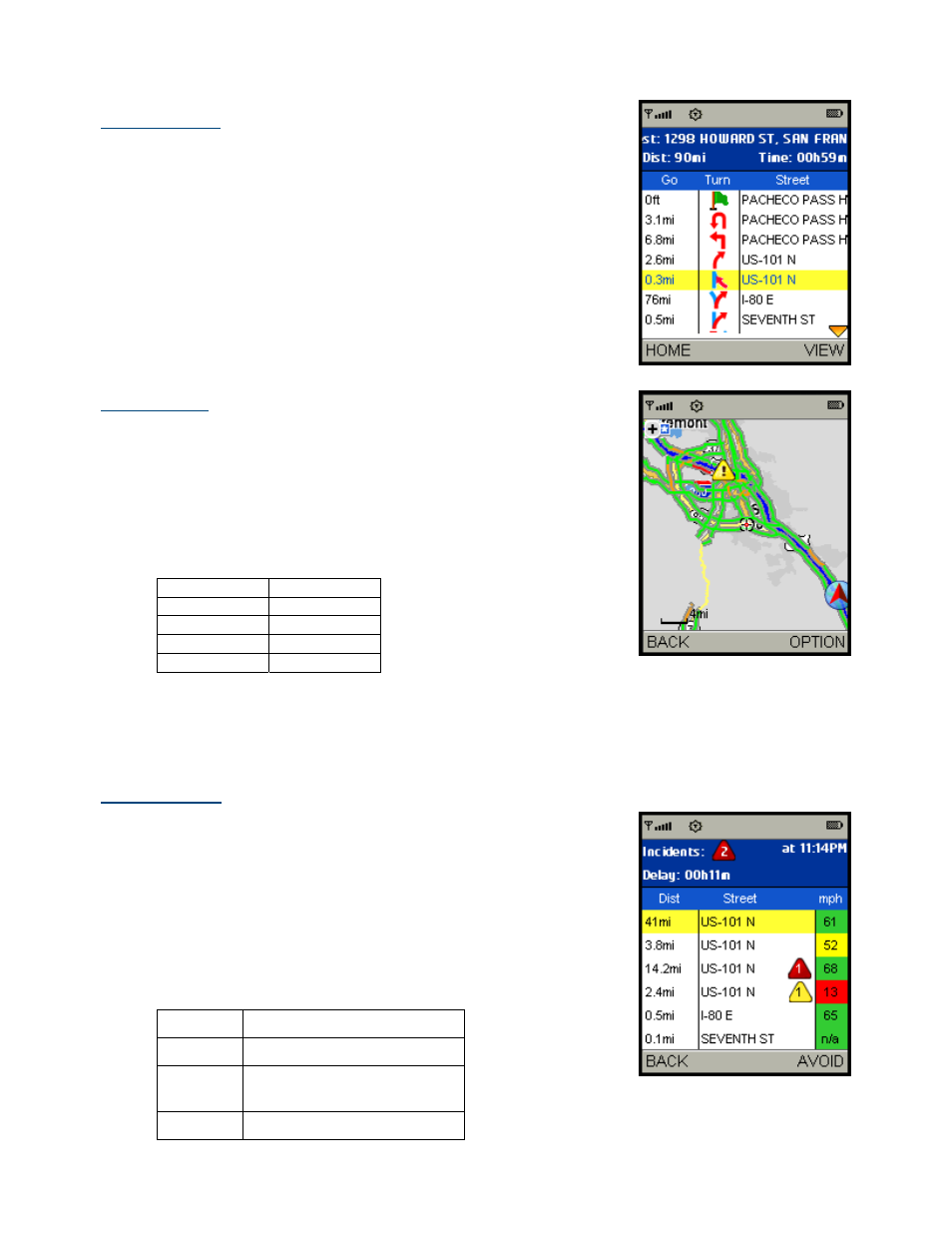
Route Summary
A text listing of every turn for this navigation session from your starting
location to your destination, along with mini turn icons.
Map Summary
The entire route from your starting location to your destination is drawn on a
map, complete with the latest traffic alerts and traffic flow information (if you
choose to view them). The route is displayed as a blue line connecting the
Start and Finish flags.
Highways and major roads with traffic flow information are color-coded by
speed in each direction of travel:
Speed Road
Color
> 50 mph
Green
30 – 50 mph
Yellow
< 30 mph
Red
Unknown Grey
1. Click
the
OPTIONS right softkey to “Hide Traffic” or “Show Traffic”
(depends on availability).
2. Use the * and # keys to zoom in and out of the map. Use the
navigation arrow keys to pan the map.
Traffic Summary
The Summary screen displays overall delay from traffic, a summary of
incidents on the route, and the average speed for each segment where
available. You can click on any line to view more details.
Below is an explanation of what you will see on the Traffic Alert screen:
• Incidents (triangle icons) - Total number of remaining incidents
directly along the route. The color of the triangle indicates
incident severity:
Color Severity
Yellow Only
Minor
incidents
Orange
At least one Major incident,
no severe incidents
Red
At least one Severe incident