Spectra Precision Survey Pro v3.80 Recon GPS User Manual User Manual
Page 46
GPS User’s Manual
42
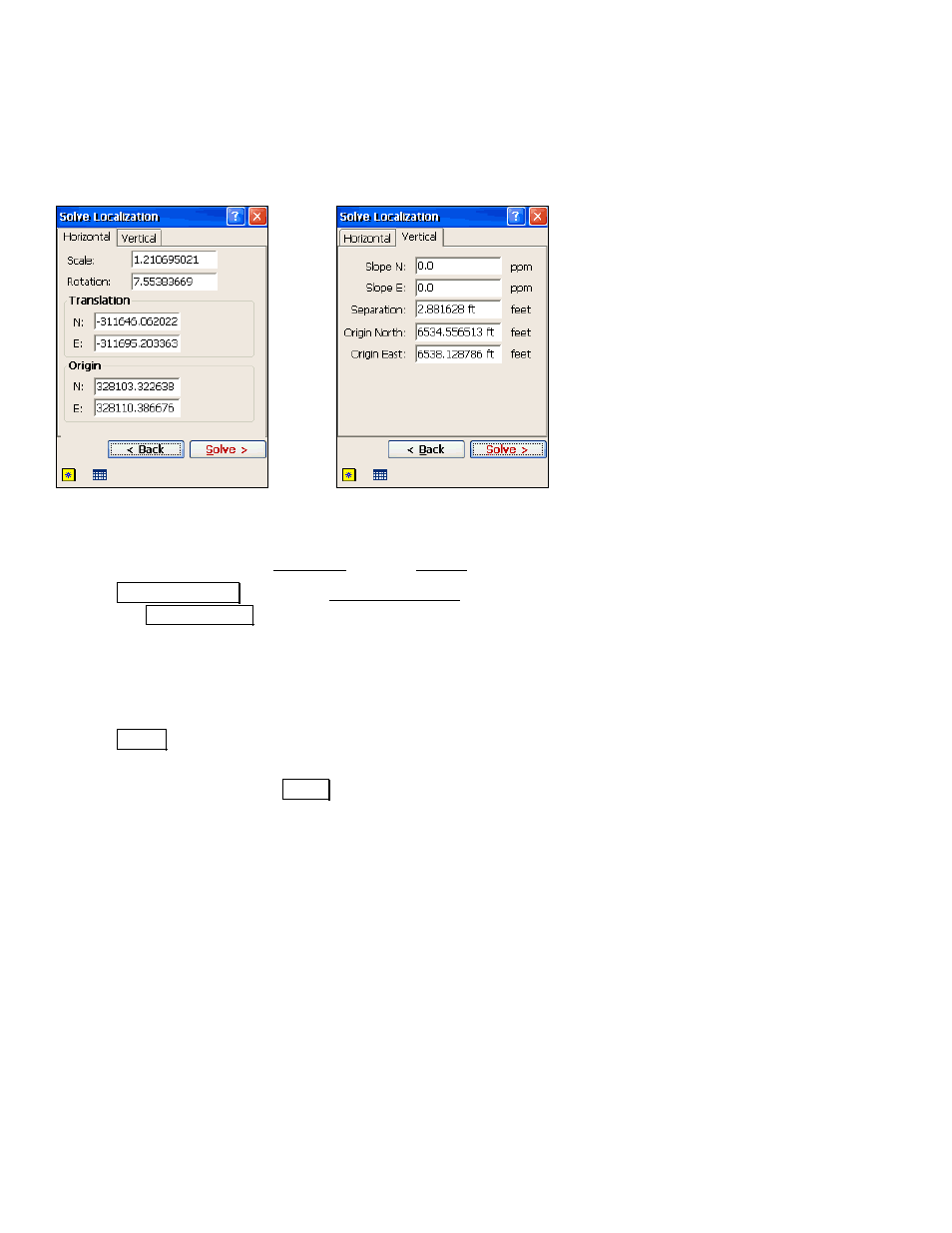
Manual Entry of Parameters
Manual entry of parameters is used when you already know the
appropriate horizontal and vertical localization parameters for a site.
Use manual entry of parameters to key in the site parameters and set
it as the current projection record.
If you already know the scale, rotation, translation, and origin for a
horizontal site, or if you know the slope, shift and origin of a vertical
site, you can manually set the localization parameters.
1.
After receiver setup, go to Projection from the Survey menu.
2.
Tap
6ROYH /RFDOL]DWLRQ to open the Solve Localization wizard and
then tap
0DQXDO (QWU\!.
3.
Enter the
Scale
,
Rotation
,
Translations
, and
Origin
of the
horizontal system.
4.
Enter the
Slope N
,
Slope E
,
Separation
, and
Origin
of the vertical
adjustment.
5.
Tap
6ROYH! to show the horizontal and vertical parameters
entered.
6.
Review the results and tap
$FFHSW when you are done.