Garmin GPSMAP 7215 User Manual
Page 29
GPSMAP
®
6000/7000 Series Owner’s Manual
23
Charts and 3D Chart Views
Showing or Hiding Hazard Colors
1. From the Home screen, select
Charts
>
Mariner’s eye 3D
>
Menu
>
Chart Appearance
>
Hazard
Colors
.
2. Complete an action:
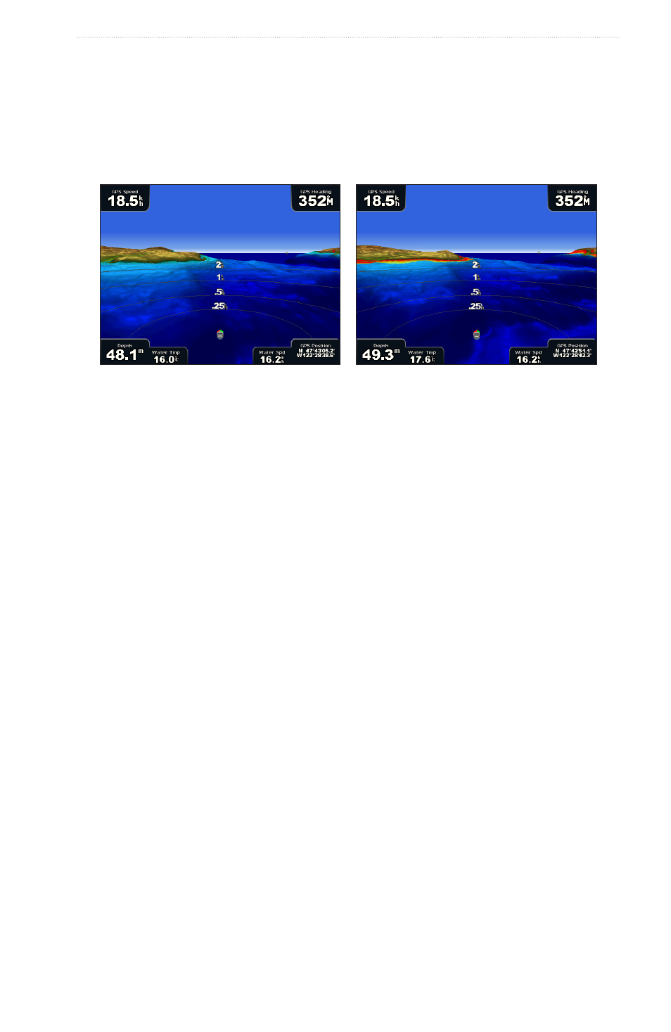
• Select
on
to view shallow water and land with a color scale. Blue indicates deep water, yellow is
shallow water, and red is very shallow water.
• Select
off
to view the land as seen from the water.
Mariner’s Eye 3D, Hazard Colors Off
Mariner’s Eye 3D, Hazard Colors On
Showing Range Rings
Selecting a Safe Depth
You can set the appearance of a safe depth for Mariner’s Eye 3D.
Note: This setting effects only the appearance of hazard colors in Mariner’s Eye 3D. It does not effect the
safe water depth Auto Guidance setting (
) or the sonar shallow water alarm setting
(
1. From the Home screen, select
Charts
>
Mariner’s eye 3D
>
Menu
>
Chart Appearance
>
Safe Depth
.
2. Complete an action:
• For the GPSMAP 6000 series, use the Rocker or the Numeric Keypad to enter the depth.
• For the GPSMAP 7000 series, use the on-screen keyboard to enter the depth.
3. Select
Done
.
Selecting a Lane Width
See “Selecting a Lane Width” (
Showing Other Vessels
See “Configuring the Appearance of Other Vessels” (
Showing Surface Radar
See “Showing Surface Radar” (
).
Showing and Configuring Data Bars
Using Waypoints and Tracks
See “Waypoints” (
) or “Tracks” (