9 service bounds configuration, Service bounds configuration – Comtech EF Data ROSS User Manual
Page 57
ROSS
MN/13070
If the surrounding polygon points are unknown, there are other methods for generating the
polygon either through global mapping applications such as Google
TM
Earth. In all cases each
polygon should be within the Satellite’s footprint.
Service bounds can also support Advanced Switching Modulator Code Tables. The Modulator
Code tables specify the modulation rate that will be utilized for requested bit-rate. This feature
allows Service Bounds to modify transmission parameters within the same beam providing
stepped condition settings. These stepped transitions could correct or overcome environmental
beam degradation areas and provide optional service level assignments (i.e. power, data rate,
modulation, etc.). This flexible mechanism allows the operator to meet any customer
requirements for specific operating conditions.
5.9
Service Bounds Configuration
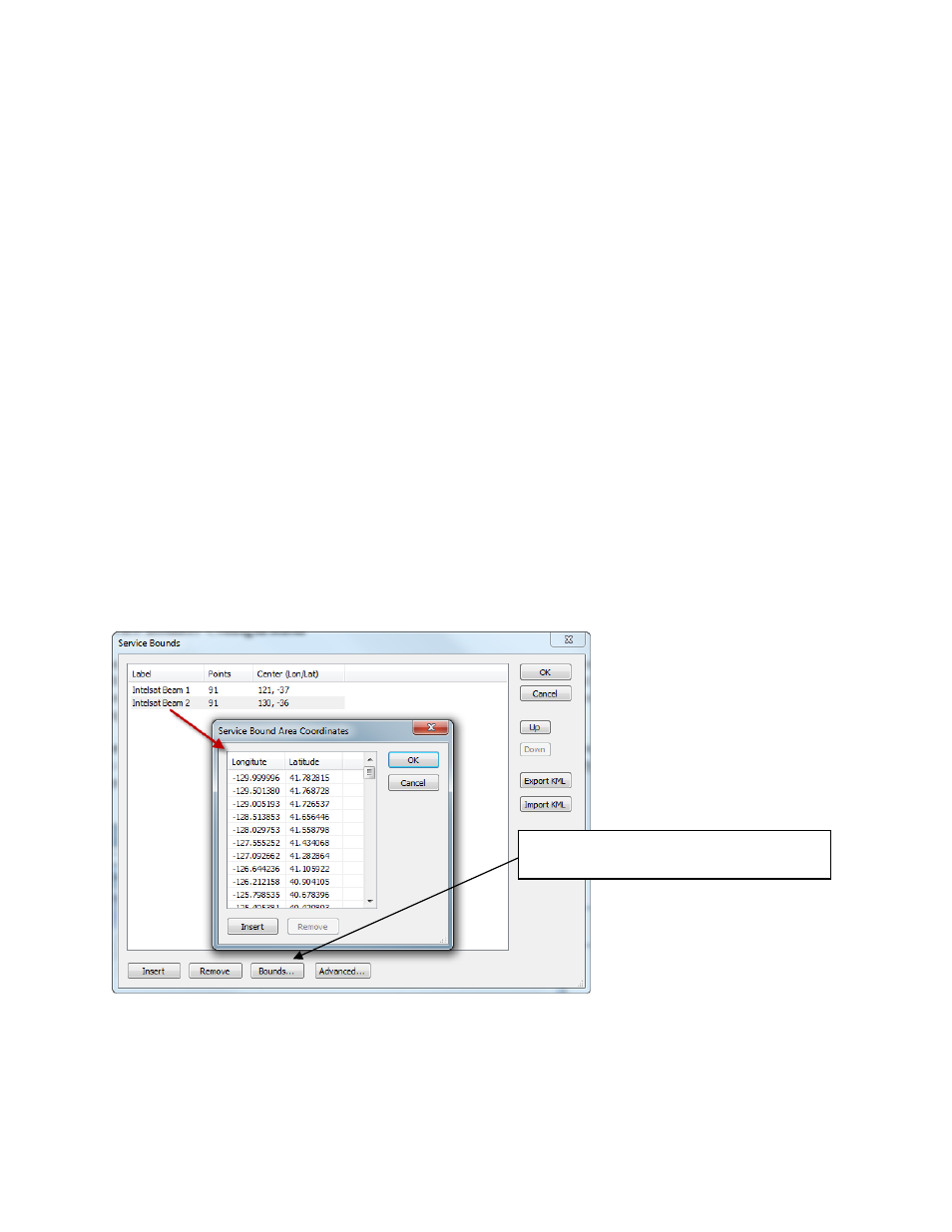
ROSS SB editor is a text-based file that conforms to the following format, Label (ID of Service
Bound), Points (the number of points within the polygon) and Center Lon/Lat (displays the
center of the polygon). The Bounds button provide the entries of the polygon longitude, latitude
as derived from your generate SB polygon data or as manually entered.
The Service Bounds window shown below illustrates two of a service bounds entry. Each entry
is a set of longitude and latitude coordinates that represent points of a polygon over a geographic
area. This polygon defines the Service Bounds.
Selecting the Bounds button provides the
point editor.
Comtech EF Data, Vipersat Products
Page 57 of 87