Nikon AW120 User Manual
Page 113
83
U
sin
g
Locati
on Data Fu
nc
ti
o
n
s/
D
isp
la
y
in
g
Ma
p
s
B
Map Display
• The map display cannot be rotated. Only the north up display (the top of the
screen indicates the north) is available.
• The map display scale varies depending on which country is shown on the map.
• In shooting mode, when Record location data in Location data options of the
Location data options menu is set to Off or when positioning could not be
performed, a world map centered on the region that was set in Time zone of
Time zone and date in the setup menu (
A76) or a map displayed just before
the current screen is displayed.
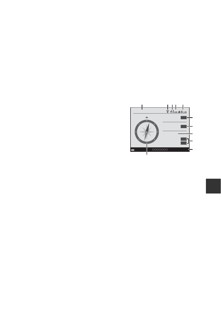
C
Notes About Direction and Location Data Display
Direction or location data, etc. is displayed when a map is being displayed in
shooting mode or if the
U (map) button is held down while the power is off.
1 Date and time
2 Eye-Fi communication indicator
3 Location data reception
4 Create log display (location data)
5 Create log display (altitude/water depth)
6 Altitude
7 Atmospheric pressure
8 Direction
9 Latitude and longitude
10 Location name information (Points of
Interest: POI)*
11 Compass display
*
“----” may be displayed for the location name information depending on the
setting level in Level of detail of Points of interest (POI).
15/05/2014 15:30
24º 19’ 21”
124º 04’ 37”
1010
NNE
1554
m
N
E
hPa
1
3
5
6
7
9
10
8
2 4
11